Scientists monitoring the Greenland Ice Sheet can copy-paste the conclusion of the result of this year’s melting season into the reports for the 27th year in a row.
Often, it’s nice to be able to reuse your work and save some time, but no one is excited to be able to copy their old status in this case, as the Greenland Ice Sheet that has shrunk for the 27th year in a row. This is shown by the continuous monitoring of the Greenland Ice Sheet.
In this year’s melting season, the Greenland Ice Sheet has shrunk by approximately 200 gigatons. You might ask yourself if that is a lot. Or even better, you can ask a relevant researcher, such as Robert S. Fausto, who is a Senior Researcher at the Department of Glaciology and Climate at the Geological Survey of Denmark and Greenland (GEUS) and works with monitoring of the Greenland Ice Sheet under the monitoring programmes PROMICE and GC-Net.
”200 gigatons sounds like a lot, but it is not a large part of the total volume of the Greenland Ice Sheet, and as an isolated case it is not worrying in itself. The worrying thing is that it is the 27th year in a row that we register that the total volume of the ice sheet is decreasing,” says Robert S. Fausto.
Mass balance is the key to understanding the size of the Greenland Ice Sheet
The Greenland Ice Sheet is not a constant and unchanging quantity – it is dynamic and changes over time, even over a relatively short period of time, such as a year. This is because it is affected by a number of processes, such as the supply of new snow and melting.
Andreas P. Ahlstrøm, Chief Consultant at GEUS, elaborates:
“Every year, we measure the amount of snowfall that contributes to the growth of the ice sheet, but this process is also changing. It happens more often now that the snow falls as rain, even high up on the ice sheet. Some years, the amount of meltwater that refreezes in the snow has been so extensive that it has created sheets of ice that stick together. And this causes subsequent years’ meltwater to run out to sea because it cannot penetrate the packed snow.”
Every year, the researchers in PROMICE and GC-Net take stock of the Greenland Ice Sheet by comparing the year’s current measurements with previous years’ measurements and with the average for the period 1991-2020. If the current year’s measurement is below average, this is not alarming in itself – the clever reader may notice large fluctuations in the individual year’s measurements in the graph below. This is to be expected.
What is worth noting is that the last 27 years of measurements have all shown that the Greenland Ice Sheet has receded.
It is easy to see in the graph below showing the total loss of mass over time.
The medical record is an important step on the way to a cure
If you are ill, a doctor ascertains what the symptoms are, and then decides what the treatment should be. Robert S. Fausto compares the researchers’ monitoring of the Greenland Ice Sheet to a nurse’s work. The researchers note the symptoms of the Greenland Ice Sheet, and then pass on the medical records.
“I usually say that we are the nurses who look after the patient: the Greenland Ice Sheet. Now we have been on the ward for many years in a row, and for the past 27 years we have been able to ascertain that this thing is happening to the patient. It shrinks and we have numbers that show it. It is now up to the doctors and the hospital director to prioritise the cure and the resources required to bring the ice sheet into balance,” says Robert S. Fausto.
Where does the water go?
The melting of the Greenland Ice Sheet affects the sea level globally. As a look at a globe will reveal, the large world oceans and the two large ice masses, the Greenland Ice Sheet and the even larger ice mass that makes up Antarctica, are connected.
When the Greenland Ice Sheet melts, it can cause seas to rise elsewhere in the world. Land masses around the equator will experience the greatest rise, because the water will go there due to the Earth’s shape and gravity. But this does not mean that only countries around the Equator that will experience a rise in sea level. If the entire Greenland Ice Sheet melts away, it could contribute to a global sea level rise of up to seven metres.
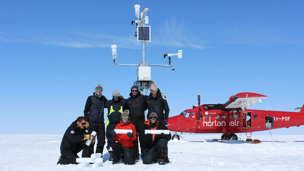
Researchers posing with some samples of the ice. (Photo: GEUS).
https://promice.org/wp-content/uploads/2023/10/Researcher-digging-in-the-wnow_Greenland-2023_GEUS_edited-scaled.jpg20002560promice_geus_dkhttps://promice.org/wp-content/uploads/2021/09/logo_promice_colour-4.svgpromice_geus_dk2023-10-05 14:42:012023-10-05 14:42:01The Greenland Ice Sheet has receded 27 years in a row
Wegener’s century old pioneering field observations from the pre-satellite era of climate change research proves valuable for re-analysis purposes today.
In a digital world, where we have become used to always verify field notes almost instantly remote sensing and climate data, it may seem there might be little use of digging into pre-satellite data. However, if the historical data are of great enough quality, they may still offer us valuable insights, as a new paper published in Scientific Reports shows.
Baptiste Vandecrux and Robert Fausto, the Geological Survey of Denmark and Greenland (GEUS), are co-authors of ‘Learning from Alfred Wegener’s pioneering field observations in West Greenland after a century of climate change’. The authors found a treasure trove of historical data. As the first author, Jakob Abermann, Institute of Geography and Regional Sciences at the University of Graz, says:
“We stumbled over many hundred pages of virtually unused records of measurements and meticulously documented metadata that Alfred Wegener had collected on his Greenland expedition almost a century ago,” Jakob Abermann reports.
Alfred Wegener’s pioneering field notes left largely untouched
The field notes were done by Alfred Wegener during his last expedition to Greenland in 1930-1931. Wegener is famous for his work within geology, but polar meteorology was one of his core interests throughout his professional research career. The motivation for his last field trip was to learn more about weather and climate in Greenland.
“Although Wegener’s field notes and his brother Kurt Wegener’s subsequent documentation are of great quality, they have been used very little for research purposes since,” Baptiste Vandecrux says.
The lack of usage might be linked to the fact that Alfred Wegener did not get to analyse the data himself, as he tragically died during the expedition in November 1930.
“We hope to reintroduce this treasure trove to climate research by presenting the core findings of the Wegener expeditions in a modern perspective. The data have been digitised and are openly available,” Robert Fausto says.
Coincide with the early twentieth century warming period
The researchers analysed Wegener’s documentation on the characteristics of snow, ice and the atmosphere and compared them with current measurements and reconstructions from climate models.
“It is astonishing how well the measurements agree with the modelling in many variables,” says Jakob Abermann.
However, the complexity of local influences is not sufficiently covered. This in turn has implications for calculations on the evolution of glaciers.
“What is exciting for us is that Wegener’s expedition years 1929 to 1931 coincide with an exceptionally warm period, which is hardly backed up with data, particularly in the Arctic. Comparisons with today are therefore particularly relevant”, explains Jakob Abermann.
In 2022, a research team set up an observation network aiming at comparing the measurement results with present-day conditions. The observed glacier has become up to 120 m thinner and retreated by more than two km since Wegener’s time.
As a next step, Jakob Abermann and his team plan to use the data obtained since last year and apply methods of artificial intelligence to determine the drivers of glacier changes. These findings will help to better estimate future changes in ice and climate.
Publication
J. Abermann, B. Vandecrux, S. Scher, K. Löffler, F. Schalamon, A. Trügler, R. Fausto, W. Schöner: Learning from Alfred Wegener’s pioneering field observations in West Greenland after a century of climate change, Scientific Reports.
Published 23 May 2023. Go to the publication here, doi.org/10.1038/s41598-023-33225-9
https://promice.org/wp-content/uploads/2023/05/2022-expedition_credits-Wally-and-Fauland.jpg10131800promice_geus_dkhttps://promice.org/wp-content/uploads/2021/09/logo_promice_colour-4.svgpromice_geus_dk2023-05-23 13:05:432023-05-23 13:32:16Unused archival data provide new context for contemporary climate change
The uppermost parts of the Greenland Ice Sheet consist of a snow type that can act as a sponge for melt water under the right conditions. However, conditions are changing and GEUS researcher Anja Rutishauser would like to find out what that means to the ice sheet ability to retain melt water.
This week Anja Rutishauser from Department of Glaciology and Climate at GEUS recieved nearly 3 million DKK (roughly 375.000 €) for her project ‘Uncovering the hydrological processes in Greenland Ice Sheet firn: A path to constraining meltwater runoff’.
She’ll be looking at the intermediate state between snow and glacier ice called ‘firn’ which sometimes acts as a sponge for melt water in the uppermost parts of the the Greenland Ice Sheet (or glaciers in general, read more about firn below article). Thus, how much melt water is either retained on the ice sheet or runs into the ocean can be greatly impacted by the dynamics of the firn layers. Dynamics of which we currently have a poor understanding.
“This new project will establish an innovative firn-hydrological observation network to make up for current lack of field observations,” Anja Rutishauser explains pointing out that right now estimates are of low confidence due to just that – lack of field data.
“By doing this, we will try to answer the currently highly uncertain question of “how much meltwater is retained in the Greenland Ice Sheet firn, and how much is runoff and contributes to global sea-level rise?”
Anja Rutishausers colleagues taking firn core samples from the Greenland ice sheet during GC-Net field work in summer 2022. Now, firn measuring branches out with a new monitoring network (credit: Anja Rutishasuer)
“Perfect synergy” with GC-Net
In spring 2023, Anja Rutishauser and colleagues will be setting up the first test versions of stationary radar equipment at the ice sheet. The project revolves around sensors called autonomous phase-sensitive radio-echo sounders or ApRES. Basically, the ApRES send out electromagnetic signals through the ice and record reflections of the signal as it hits changes in snow, firn and ice properties on its way down. Similar to a bat or a dolphin, although a different type of wave. This will hopefully enable Anja Rutishauser to detect changes in the firn such as density, thickness of different layers or saturation.
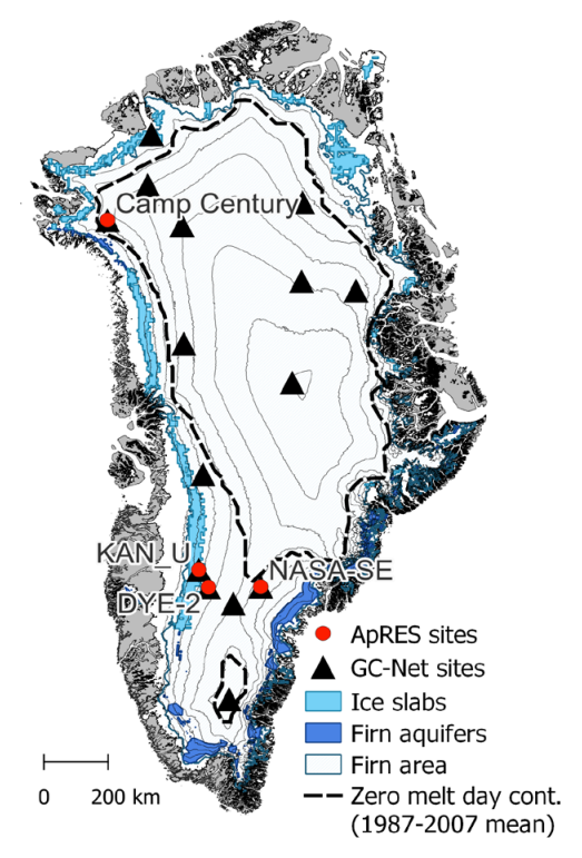
Sites of planned ApRES along with current GC-Net positions and firn areas of special interst (Credit: Anja Rutishauser, GEUS)
The ApRES will be placed next to the GC-Net stations which is the perfect syngery, Rutishauser explains.
“The GC-Net stations are all placed in the central part of the ice sheet where the firn layer is of most significance to melt retainment and they send home valuable information about physical conditions in near real time. This information will be great to help understand the firn dynamics we aim to record with ApRES and vice versa.”
Adding the ApRES will be a bit like adding x-ray vision to the GC-Net stations, further extending the sensory reach below the surface.
Also, the GEUS team is visiting the GC-Net stations almost every year for maintenance which makes for logistic synergy as well. Which is not something to pass up in the Arctic.
The equipment has not been used for looking at near-surface firn before, Rutishauser explains, so she is excited to test it out. She has experience with the technology from previous work in Canada and Antarctica. The researcher also knows the GC-Net stations well, having spent several weeks during 2022 setting up new ones along the West coast of Greenland. Read her blog post about it at EGU blogs here.
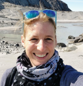
Researcher Anja Rutishauser in Greenland (credit: Anja Rutishauser)
Firn is an snow that ‘survived’ a melt season and is an intermediate state between snow and glacier ice. The word firn derives from the Swiss German for ‘last year’. The further down the firn gets buried under new snow the more condensed it gets, eventually making the individual firn crystals merge and form increasinly large ice crystals. With enough time and pressure, what started out as snow will become smooth glacier ice.
The borehole in the ice sheet from a 10 meter firn core sample (credit: Anja Rutishauser)
https://promice.org/wp-content/uploads/2022/11/IMG_20220617_153353-scaled.jpg19202560promice_geus_dkhttps://promice.org/wp-content/uploads/2021/09/logo_promice_colour-4.svgpromice_geus_dk2022-11-16 18:29:492023-05-23 13:32:27New research project will track changing sponginess of the ice sheet
Global warming is changing the Arctic by causing permafrost thaw, glacier melt, droughts, fires and changes in vegetation. These developments are strongly linked to the energy exchange between land and the atmosphere strongly influenced by vegetation type which researchers has now helped uncover with data from PROMICE and GC-Net.
The Arctic’s diverse vegetation is one of the key factors in the energy exchange between the Earth’s land surface and the atmosphere which is so far disregarded in climate models. This is the conclusion of a newly published paper in Nature Communications by a team of international researchers including GEUS.
Arctic vegetation is highly diverse and ranges from dry grasslands and wetlands to scrubland dominated by dwarf shrubs as well as barrens with mosses and lichens. The researchers linked this vegetation diversity to all available energy exchange data collected in the Arctic between 1994 and 2021 including GEUS’ ice and glacier monitoring data from PROMICE, GC-Net and GEM as main sources.
“We now know which plant communities have a particularly pronounced cooling or warming effect through energy exchange. This enables us to determine how changes in plant communities, which are occurring in many regions in the Arctic, are affecting permafrost and the climate,” says UZH professor Gabriela Schaepman-Strub from the Department of Evolutionary Biology and Environmental Studies of the University of Zurich (UZH), leading the study.
Especially shrubs will drive up the amount of energy going into the terrain, researchers found, compared to lower and lighter colored type vegetation.
“Remarkably, in summer the difference in heat flux between two types of vegetation – such as a landscape dominated by lichens and mosses and one with shrubs – is about the same as between the surface of glaciers and green grasslands,” postdoc Jacqueline Oehri first author of the paper explains.
“The shrubs’ dark branches emerge from under the snow early, absorb sunlight and pass it on to the surface long before the snow melts away,” she adds.
Ice data as important reference
The study’s data make it possible to incorporate the effects of different plant communities and their distribution into climate predictions. Researchers can thus use improved climate models to calculate whether, and to which extent tundra vegetation in the Arctic plays a role in cooling the land surface. And to what extent this will change with changing climate and thus changing vegetation in the far North.
Another key driver of the energy exchange in the Arctic is of course the ice- and snow-covered areas, the light surface acting as a somewhat stable cooling agent, historically. Therefore, energy exchange data from ice- and snow-covered areas served as an important baseline for the study, co-author and GEUS glaciologist Baptiste Vandecrux explains.
“This study actually shows how data from ice focused monitoring projects such as PROMICE and GC-Net can help understand the ice-free areas better as well. Everything is changing so rapidly in the Arctic and having a baseline for energy fluxes on the ice sheet can help monitor a range of different changes happening in the rest of the region,” says Vandecrux.
Almost 20 years’ worth of energy flux data gathered by GEUS amongst others between the ice sheet surface and atmosphere helped establish the norm for fluxes at ice- or snow-covered surfaces in general. Which includes most of the Arctic for most of the year.
Preserving permafrost in the tundra
“Our findings on the energy flows in the Arctic are extremely relevant, since the preservation of permafrost depends to a large extent on the heat flux into the ground,” says Schaepman-Strub.
Rapid changes of climate in the Arctic will however include equal changes in vegetation patterns thus requiring improvements in data collection, she says.
Although the Arctic is changing rapidly and has a major impact on the climate dynamics of the entire planet, there are only few reliable measuring stations in this region of which GEUS oversees the majority. In addition to calling for current stations to remain in operation, the study authors believe new stations are needed in those Arctic landscape types that could only be partially analyzed due to incomplete data.
About GEM
Greenland Ecosystem Monitoring (GEM) is an integrated monitoring and long-term research programme on ecosystems and climate change effects and feedbacks in the Arctic running since 1995. GEUS is running the part of the project monitoring glacier and ecosystem dynamics called GlacioBasis.
https://promice.org/wp-content/uploads/2022/10/Umi23sept17-34-scaled.jpg17072560promice_geus_dkhttps://promice.org/wp-content/uploads/2021/09/logo_promice_colour-4.svgpromice_geus_dk2022-10-31 14:10:352023-05-23 13:33:35Vegetation drives heating and cooling in the Arctic
Every year in September, the annual melting season in Greenland is over, and glaciologists from GEUS take stock of the past 12 months’ ‘budget’ for the Greenland Ice Sheet and calculate whether the sheet has, overall, become bigger or smaller. This year, once again, it is unfortunately the latter.
In this melting year, much more ice has disappeared from the Greenland Ice Sheet than has formed, and it is the 26th year in a row that this is the case. In total, the ice sheet has lost approximately 84 billion tons of ice since last season. These are, of course, huge quantities, but they are still at the lower end of what has been the norm over the past few decades, with a general increase in melting. This is according to Chief Consultant and Glaciologist Andreas Ahlstrøm from the Geological Survey of Denmark and Greenland (GEUS).
“The melting of the Greenland Ice Sheet in the melting year 2021 to 2022 has raised the water level in the world’s oceans by approximately 0.2 millimetres. So even though it’s less than we’ve seen in the past, it’s still contributing to the growing problem,” he says. Last melting year, for instance, the ice sheet lost 172 billion tons of ice, which corresponds to almost half a millimetre of global sea level rise (see graph for sea level rise below article)
The amount of ice melting in a year is partly determined by natural variation, but since 1997, the Greenland Ice Sheet has lost mass every year. The record so far is the melting year 2011 to 2012 with approx. 460 million tons of ice, i.e. approximately five times more than this year (see accumulated mass loss since 1986 below article).
The European heatwave helped
In fact, the extremely hot summer in Europe may have contributed to the fact that this year there was a little less melting than usual, explains Andreas Ahlstrøm:
“We often see that heat waves in Europe bring about the opposite in Greenland, which tends to experience colder weather than usual during these periods. This can lead to less melting.”
As the climate globally gets warmer, scientists expect more heat extremes like those that hit Europe this year. Some years they will hit Europe, other years, it will be Greenland and the Greenland Ice Sheet or a third place.
Researchers at GEUS make the annual status of the ice sheet’s so-called mass balance, when the ice has gone through a winter season and a subsequent melting season. This is called a hydrological year or a ‘melt year’, and it runs from September to August. You can also calculate the mass balance of the ice in ordinary calendar years, but in that case, the calculation will consist of two half winter seasons and a summer season as opposed to one total winter season and subsequent summer season.
The dividing line for a hydrological year is set on September 1st because that is approximately when the ice usually enters the winter season; when it begins to build up mass again rather than losing it.
Weather stations monitor ‘the pulse of the ice’
We only know whether ice is added to or lost from the Greenland Ice Sheet over the course of a year, because a lot of people ‘check the pulse of the patient’ on a daily basis and have done so for many years.
It quite simply depends on how much it snows compared to how much ice melts and breaks off as icebergs. And that requires a lot of data on where the ice formation and melting take place, as well as how and why.
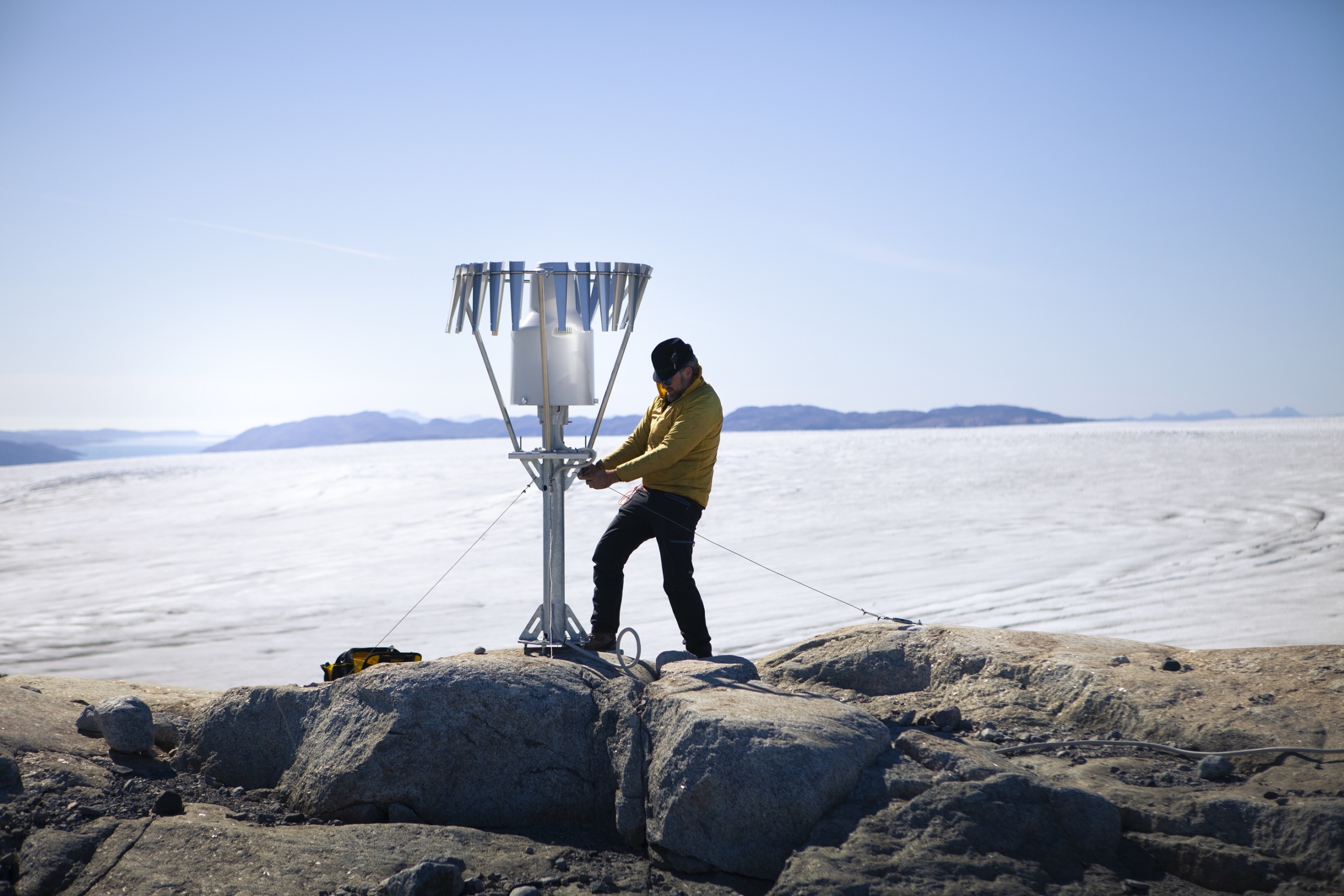
This is the why GEUS leads a large monitoring program on the melting and dynamics of the Greenland Ice Sheet, which consists of two sister projects: Greenland Climate Network (GC-Net) and Program for Monitoring of the Greenland Ice Sheet (PROMICE).
Photo: Maintaining a PROMICE automatic weather station on a small unnamed peripheral glacier in Southwest Greenland, near Nuuk. (W. Colgan/GEUS)
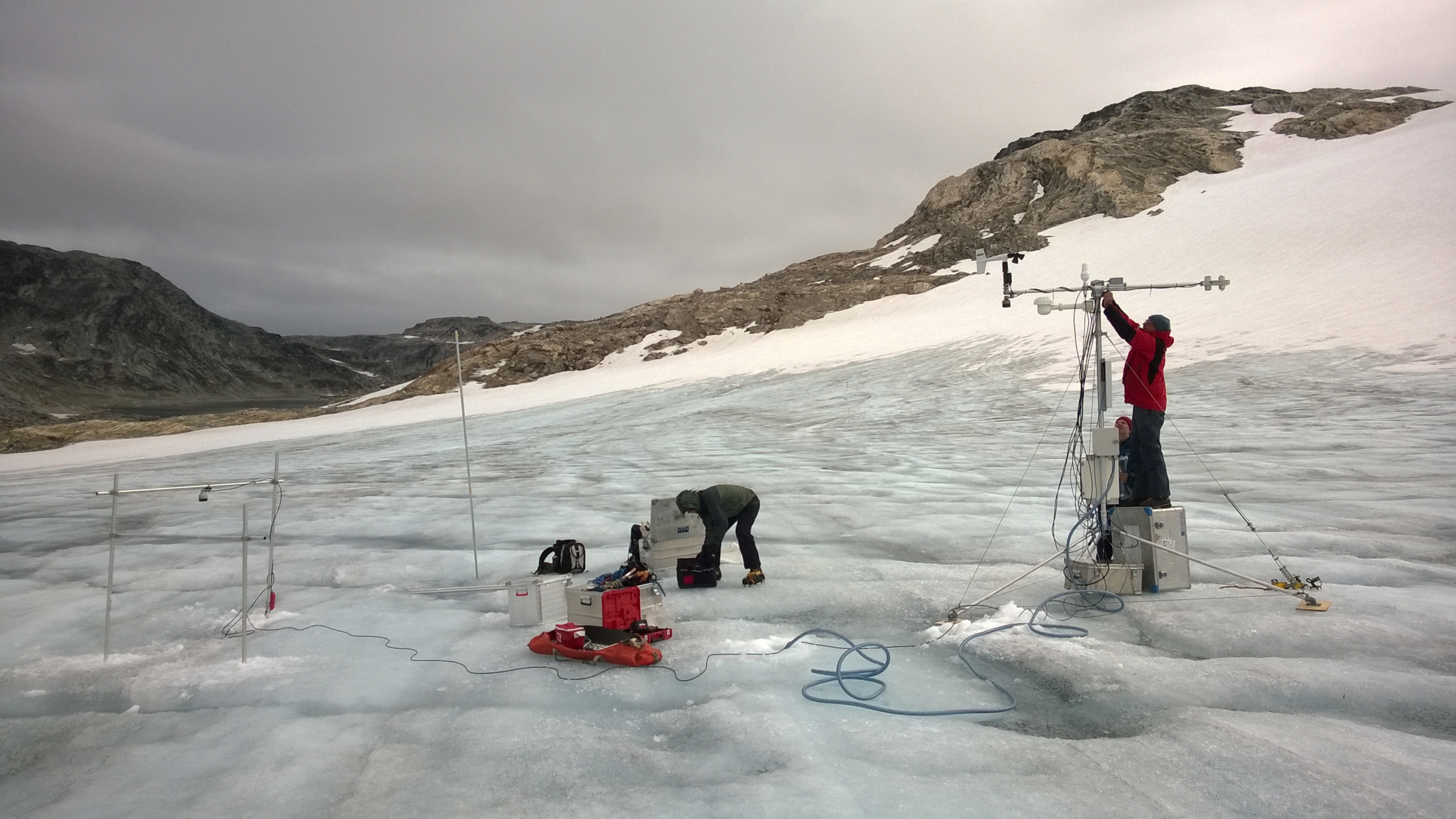
GEUS has more than 40 automatic weather stations located all over the Greenland Ice Sheet and connects measurements from them with satellite measurements and field observations. The data is linked with climate models from e.g. DMI, and with that data, both the daily and annual melting from the ice is calculated.
GEUS continuously develops the weather stations to keep up with the rapid development of the Arctic climate. Every spring and summer, the researchers spend many days on the Greenland Ice Sheet, traveling around and inspecting the precious equipment. The measurements are used by many researchers worldwide, and they are included in the IPCC’s status reports on climate change and its effects.
For several weeks in May 2022, Andreas Ahlstrøm was on the ice with a team of GEUS colleagues to monitor and update weather stations along the north-eastern flank of the Ice Sheet.
“For instance, we have put rain gauges on our weather stations so that we can monitor the influence on the ice by the still more frequent Arctic rains,” he says.
See our data for accumulated mass loss and sea level rise below (click on graph for full size view).
https://promice.org/wp-content/uploads/2022/09/175-May-24-6-57-34-AM-scaled.jpg18462560promice_geus_dkhttps://promice.org/wp-content/uploads/2021/09/logo_promice_colour-4.svgpromice_geus_dk2022-09-14 17:12:492023-05-23 13:53:24For the 26th year in a row, the Greenland Ice Sheet is shrinking
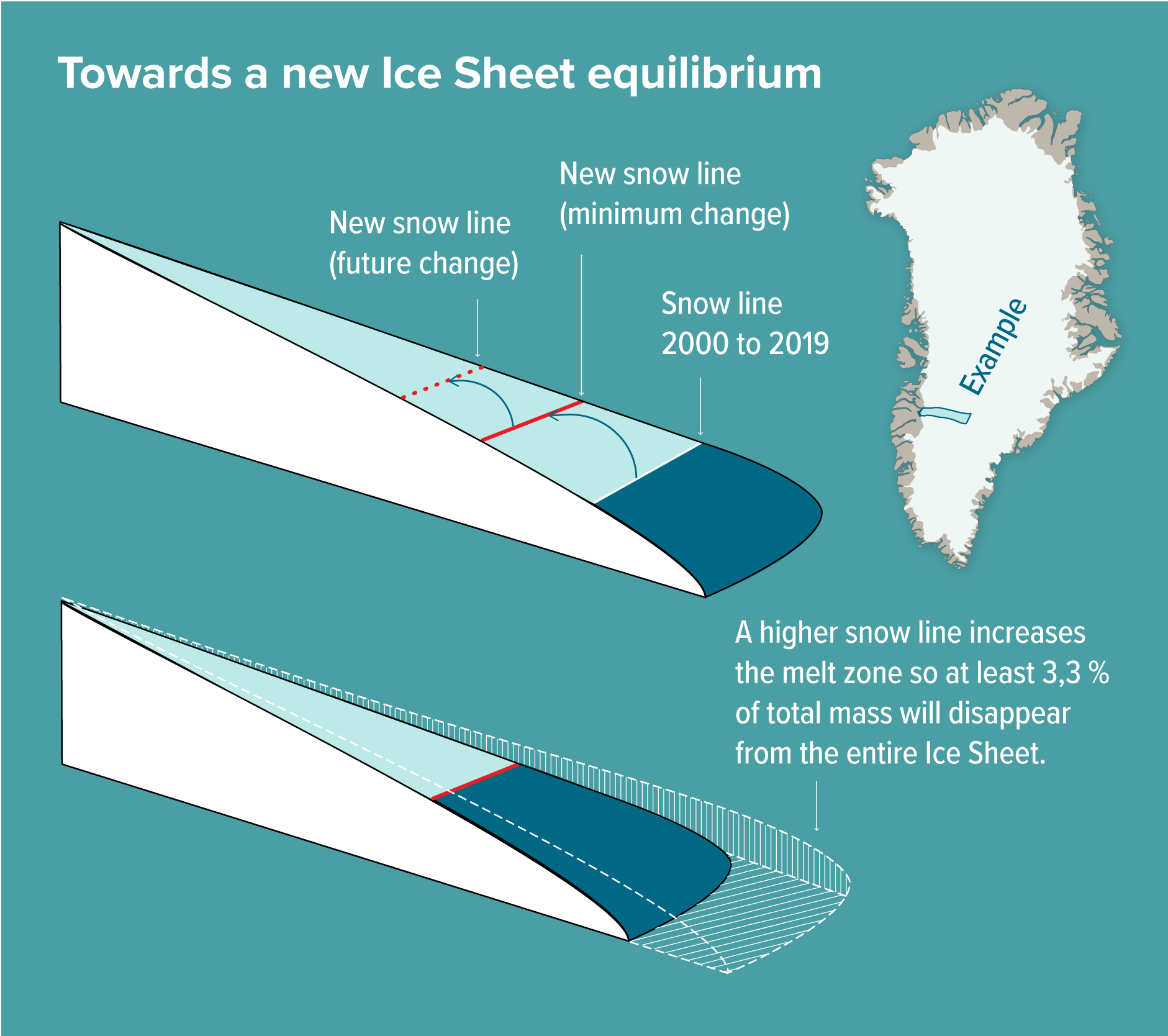
Based on two decades worth of measurements instead of models, glaciologists have for the first time determined the minimum ice loss committed from the Greenland Ice Sheet as from the climate warming so-far. This leaves out the uncertainty of any positive or negative future climate scenario, letting us know the absolute lower bound for what’s to come.
Note: This article has been edited in order to correct an error in mass loss; originally the article stated a mass loss of 110 quadrillion tonnes, the correct number is 110 trillion tonnes.
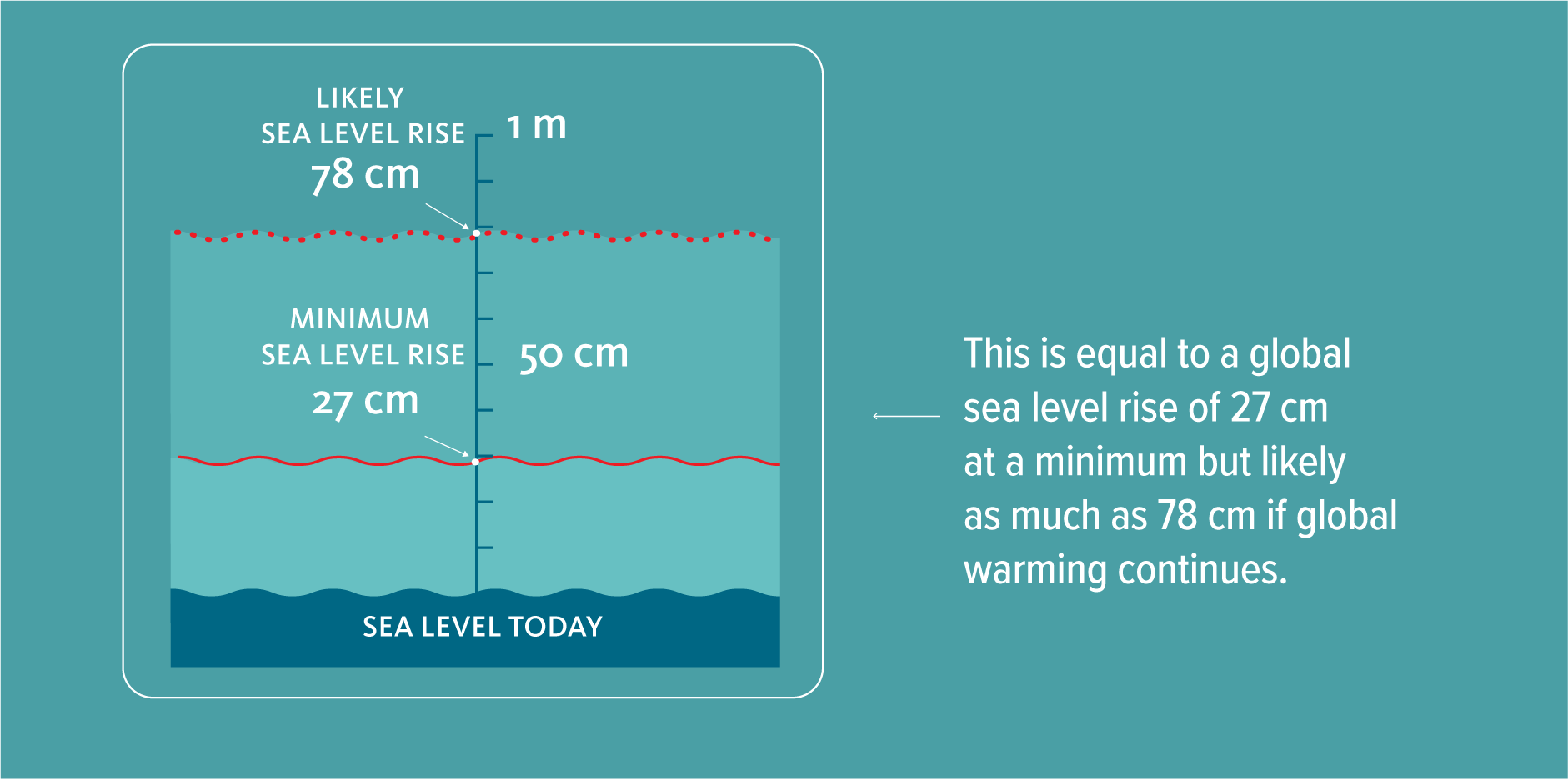
Even if the whole world stopped burning fossil fuels today, the Greenland Ice Sheet would still lose about 110 trillion tonnes of ice leading to an average of global sea level rise of at least 27 centimetres.
By looking at the climate in the Arctic from 2000 to 2019 and the imbalance it has created in the Greenland Ice Sheet, researchers have calculated that the shape of the ice is set in motion to correct this imbalance – inevitably – by losing 3.3 percent of its current volume, which corresponds to the numbers mentioned.
Actually, this is a low estimate according to the lead author on the study just published in Nature Climate Change, Professor Jason Box from the National Geological Survey of Denmark and Greenland (GEUS).
“It is a very conservative rock-bottom minimum. Realistically, we will see this figure more than double within this century,” he says and elaborates:
“In the foreseeable scenario that global warming will only continue, the contribution of the Greenland Ice Sheet to sea level rise will only continue increasing. When we take the extreme melt year 2012 and take it as a hypothetical average constant climate later this century, the committed mass loss from the Greenland Ice Sheet more than doubles to 78 cm.”
Notably, this study is only looking at the situation of the Greenland Ice Sheet, not considering the mass loss from Antarctica or other glaciers around the world.
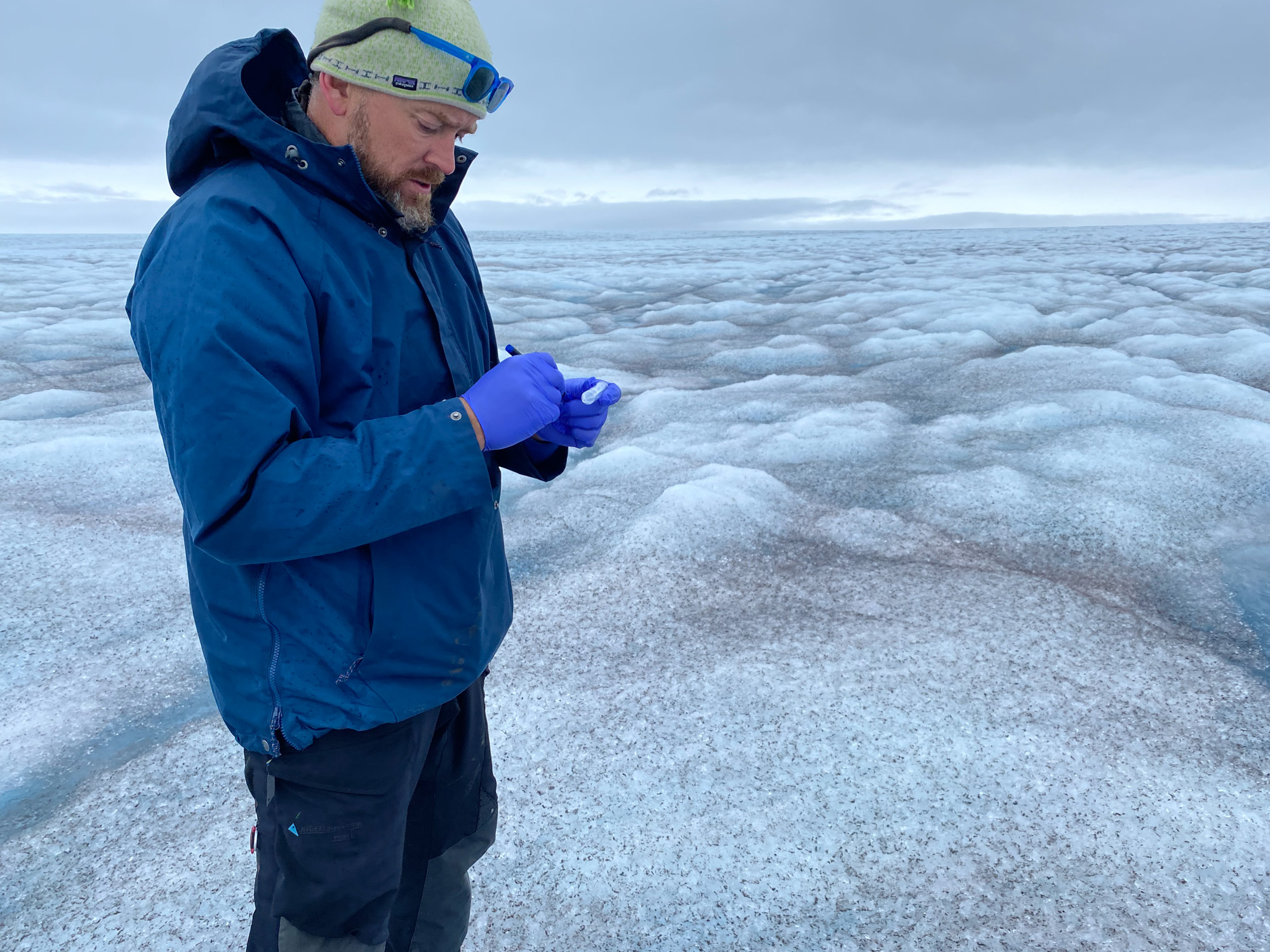
Professor Jason Box from GEUS taking ice samples standing on exposed ice below the snow line of the Greenland Ice Sheet in West Greenland during the melt season (credit: The Geological Survey of Denmark and Greenland, GEUS)
Ice models cannot keep up
It is a complete novelty for researchers to be able to put a minimum figure on the melting from the Greenland Ice Sheet in this manner. A figure that does not depend on highly uncertain computer models of the ice flow and climate interaction but on actual measurements of the ice obtained with satellites and the researchers’ own observations over the last two decades.
Now there’s enough data points to see that the balance in the last two decades worth of annual addition and loss of mass from the ice sheet simply ‘requires’ the ice to lose at least three percent of its mass to the ocean. Otherwise, the physics don’t add up.
This radically different method has already raised some eyebrows in the science community by the mere rumour preceding the actual publication of the scientific paper, Professor Box says. He stresses, that this new way of doing things is of the utmost importance.
“The ice flow models are not ready in this area. This is a complimentary way of calculating mass loss that has been lacking,” says Professor Box. He emphasizes that the downside to this method is that it does not give a timeframe.
“In order to get the figure that we have, we had to let go of the time factor in the calculation. But our observations suggest that most of the committed sea level rise will occur this century.”
The GEUS glaciologist team setting up one of many automatic weather stations on the snowy surface above the snow line in order to follow the changing dynamics (credit: The Geological Survey of Denmark and Greenland, GEUS)
How did they do it?
The researchers have looked at changes in the so-called snow line of the ice sheet – the boundary between areas of the ice sheet that are exposed to net melting during summer and the areas that are not. The ice does not melt equally all over the surface but primarily along the edges at the warmer lower elevations. Further up the ice sheet, it is too cold for net surface melting to occur even in summer. The boundary between melting and no melting, the snow line, is set by the line where the upper layer of winter snow does not melt away in summer but remains on top, nourishing the ice sheet.
The snow line varies from one year to the next, depending on the weather conditions. A hot summer may mean that the boundary moves further up the ice sheet, thus increasing the melt area and with it the amount of ice melting from the surface that year. In colder years, the melt area can decrease, pushing the snow line down towards the ice edges allowing less mass to be lost.
In the recent (2000–2019) climate, the Greenland ice has built up a disequilibrium which will inevitably correct itself by reducing total mass by at least 3.3 percent in order to regain equilibrium at a new average snow line in a higher alteration. (credit: The Geological Survey of Denmark and Greenland, GEUS)
The snow falling on the ice during winter turns into new ice over time. If the snow does not melt away during summer, that is. In order for the ice sheet to be in equilibrium, the added mass must equal the lost mass. In a stable climate, that’s the case. If a hot summer causes the layers of snow to be lost by melt, that snow will be missing in the mass budget for years to come, creating a mass budget deficit or disequilibrium.
It is this disequilibrium Professor Box and colleagues has calculated the consequence of based on more than a decade of research. Using a rigorous glaciological theory abiding the physics of ice flow based on measurements from satellites and other observations, they calculated the average snow line needed to bring the ice sheet back into balance. This average snowline increases the melt area resulting in increased imbalance and ultimately a slower alteration of the shape of the ice sheet. Now equivalent with losing an absolute minimum of 3.3 percent of total volume, equal to 110 trillion tonnes of ice or a sea level rise of 27 cm.
As a lower bound, the Greenland Ice Sheet is committed to lose 3.3 % of current mass possibly within this century. This corresponds to:
110 trillion tonnes of ice (110,000,000,000,000 tonnes)
Covering the entire United States with 11 meters of water (37 feet)
https://promice.org/wp-content/uploads/2022/08/20220620_165724-scaled.jpg19202560promice_geus_dkhttps://promice.org/wp-content/uploads/2021/09/logo_promice_colour-4.svgpromice_geus_dk2022-08-29 17:00:192023-09-15 10:01:30Now we know how much ice will melt from Greenland at the very least
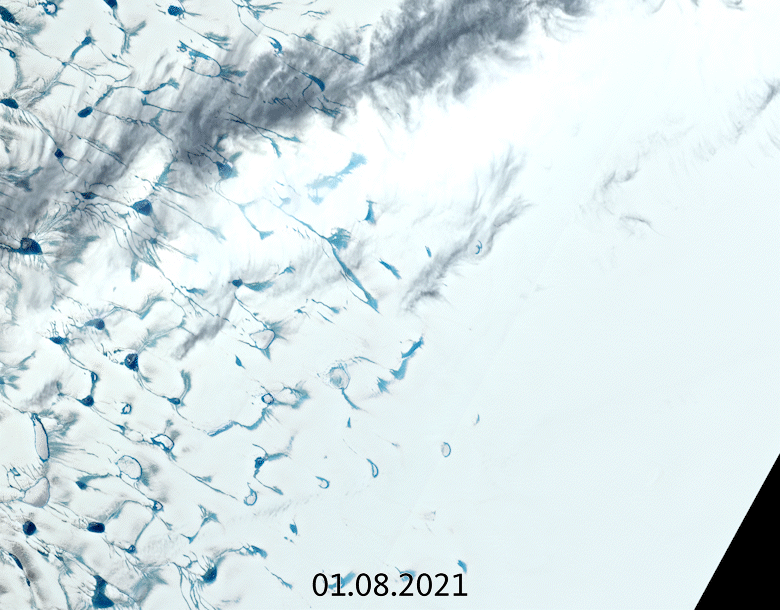
For the first time ever recorded, in the late summer of 2021, rain fell on the high central region of the Greenland ice sheet. This extraordinary event was followed by the surface snow and ice melting rapidly. Researchers now understand exactly what went on in those fateful summer days and what we can learn from it.
The never-before-seen rainfall, on 14 August 2021, made headlines around the world. The upper-most parts of Greenland’s enormous ice cap used to be too cold for anything other than snow to fall, but not anymore.
What caused this extreme event and how did it affect the ice? Researchers from the Department of Glaciology and Climate at the Geological Survey of Denmark and Greenland (GEUS) in collaboration with colleagues from France and Switzerland have since scrutinised these questions and come up with the answers.
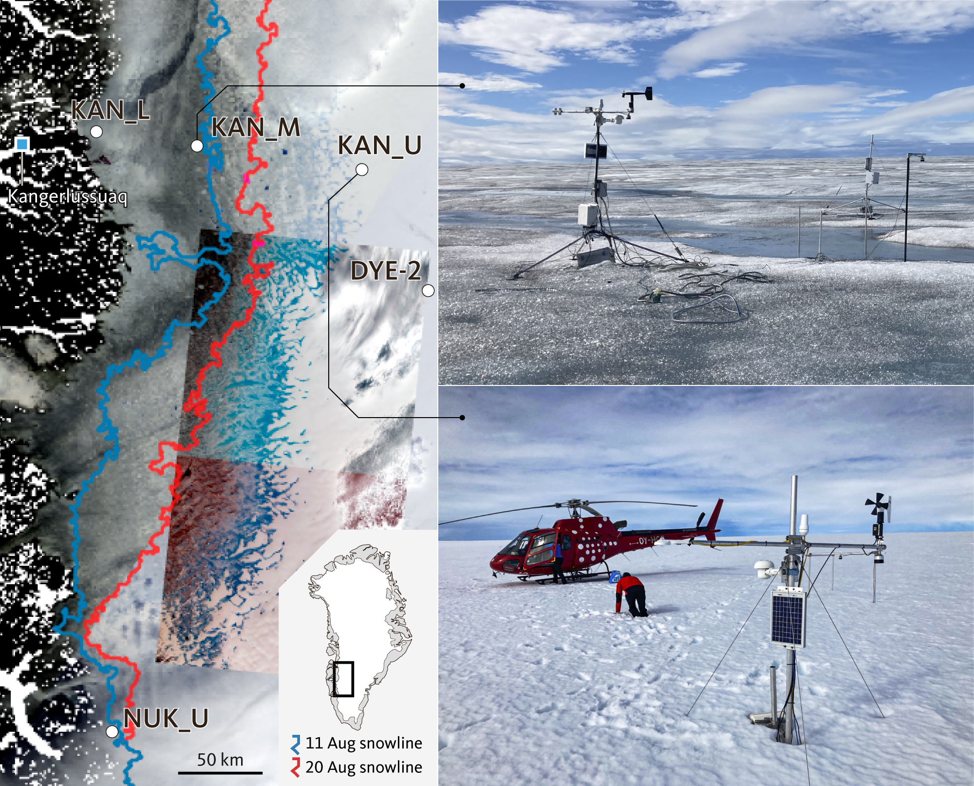
It didn’t only rain at Summit Camp – rain was measured by new automatic weather stations placed across the ice sheet by GEUS’ ice-sheet monitoring projects Programme for Monitoring the Greenland Ice Sheet (PROMICE) and Greenland Climate Network (GC-Net).
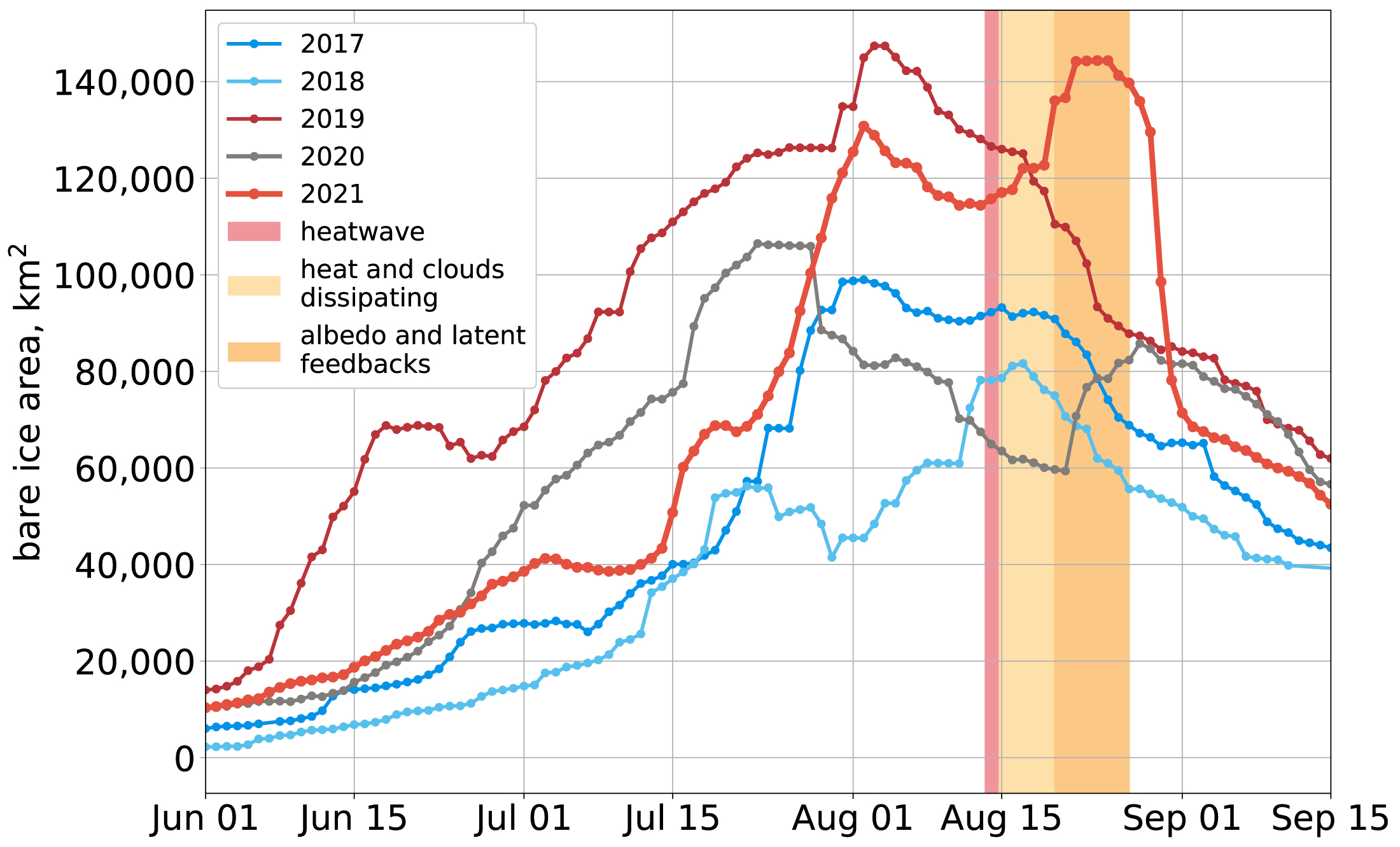
Studying detailed data from these stations alongside measurements of surface reflectivity, or albedo, from the Copernicus Sentinel-3 satellite mission and information on atmospheric circulation patterns, the researchers discovered that the rain had been preceded by a heatwave at a time of year when seasonal melting is usually slowing down.
From the onset of the August heatwave in 2021, the surface of the ice sheet (here seen east of Kangerlussuaq) became notably darker due to melting snow, lowering the albedo and making it melt way more than expected for that time of year. (GIF: Edited by GEUS, images from Copernicus Sentinel-2, ESA)
It wasn’t the rain
“It turns out that the rain itself wasn’t the most important factor”, says Prof. Jason Box from GEUS and lead author of the paper reporting their results, which were just published in Geophysical Research Letters.
“There is an irony. It’s not really the rain that did the damage to the snow and ice, it’s the darkening effect of the meltwater and how the heat from the event erased snow that had overlaid darker ice across the lower third of the ice sheet.
“Unusually warm atmospheric rivers swept along Greenland in the late summer months, bringing potent melt conditions when the melt season was drawing to a close.”
In fact, this sudden increase of surface ice melt on Greenland could have happened without any rain ever touching the ground.
The main culprit was the heat itself, melting and completely removing the surface snow, thereby changing the surface albedo, Greek for ‘whiteness’, so that Greenland snow and ice absorbed more of the Sun’s rays.
The researchers found that, between 19 and 20 August 2021, this melt caused the altitude of the ice sheet’s snowline to retreat by a whopping 788 metres, exposing a wide area of dark bare ice (see below).
One of the areas of the ice sheet hit by the heat wave, causing the snowline to retreat immensely in a short period of time. This is along the PROMICE/GC-Net Kangerlussuaq transect of automatic weather stations (white dots) from where the researchers documented the very warm, wet ice and snow conditions during their field work. Usually the snow at KAN_U station is not this difficult to walk in during august. (Illustrations: GEUS, edited from Box et al. 2022 by C. Thuesen, photos Dirk van As).
Under normal circumstances, snow would cover and insulate this ice, but the snow melted suddenly and exposed the ice to heat, causing even more melting.
Since 2017, Prof. Box and colleagues have been consistently monitoring these melt dynamics with data from the Copernicus Sentinel-3 mission as part of their research supported by ESA’s Earth Observation Science for Society programme.
They found that more bare ice had been exposed on the one day of 19–20 August than any other day since their research began (see below).
Area of bare ice measured from 2017 to 2021, where the heatwave in 2021 greatly increases bare ice extent very late in the melt season. (Illustration: Edited from Box et al. 2022 by C. Thuesen, GEUS)
So, what does this mean?
The authors conclude that the heatwave causing the rain event serves as an excellent example of ‘melt-albedo feedback that amplifies the melt impact of the initial melt perturbation’.
Besides the obvious concern of making the ice sheet melt faster while this was happening, studying the event using detailed measurements from the network of automatic weather stations on the ice set up by GEUS coupled with measurements from the Copernicus Sentinel-3 satellites helps understand the exact processes and dynamics of how ice melts.
Even though the rainfall was a shock and a milestone in climate history, researchers knew it was bound to happen sooner or later, given the rising temperatures of the Arctic.
Therefore, Prof. Box and the co-authors encourage research to look further into the workings behind atmospheric rivers and not just rainfall.
They conclude that understanding the frequency of heatwaves, appears to be a more significant research target than the liquid precipitation that heatwaves may or may not produce.
The study explained by Prof. Jason Box
The 2021 august melt event
The ‘atmospheric river’ heat wave causing the rain event in mid-August 2021 was the actual cause of the following surface melt, not the rain itself.
The heat wave caused extensive melting to happen unusually late in the season.
The melt event caused the snow line to elevate by an extreme amount (788 m), exposing a wide area of dark bare ice.
The ice sheet had more than four days of wet snow cover in August which is double the normal amount.
The Watson River rose abruptly to record high values for that late part of the melt season, demonstrating independently the off-ice impacts of the heatwave in increasing meltwater delivery into the ocean, rising sea level.
Read the paper
The Mid-August 2021 Greenland Ice Sheet Heatwave with Rainfall: Extreme Melting Sustained by Albedo Feedback (DOI:10.1029/2021GL097356) published in Geophysical Research Letters.
Authors and institutions:
Jason E. Box, Dirk van As, Robert S. Fausto, Kristian K. Kjeldsen, Armin Dachauer, Andreas P. Ahlstrøm, the Geological Survey of Denmark and Greenland (GEUS), Copenhagen, Denmark
Adrien Wehrlé, Institute of Geography, University of Zurich, Zurich, Switzerland
Ghislain Picard Geological Survey of Denmark and Greenland (GEUS), Copenhagen, Denmark and UGA, CNRS, Institut des Géosciences de l’Environnement (IGE), UMR 5001, 8 38041 Grenoble, France
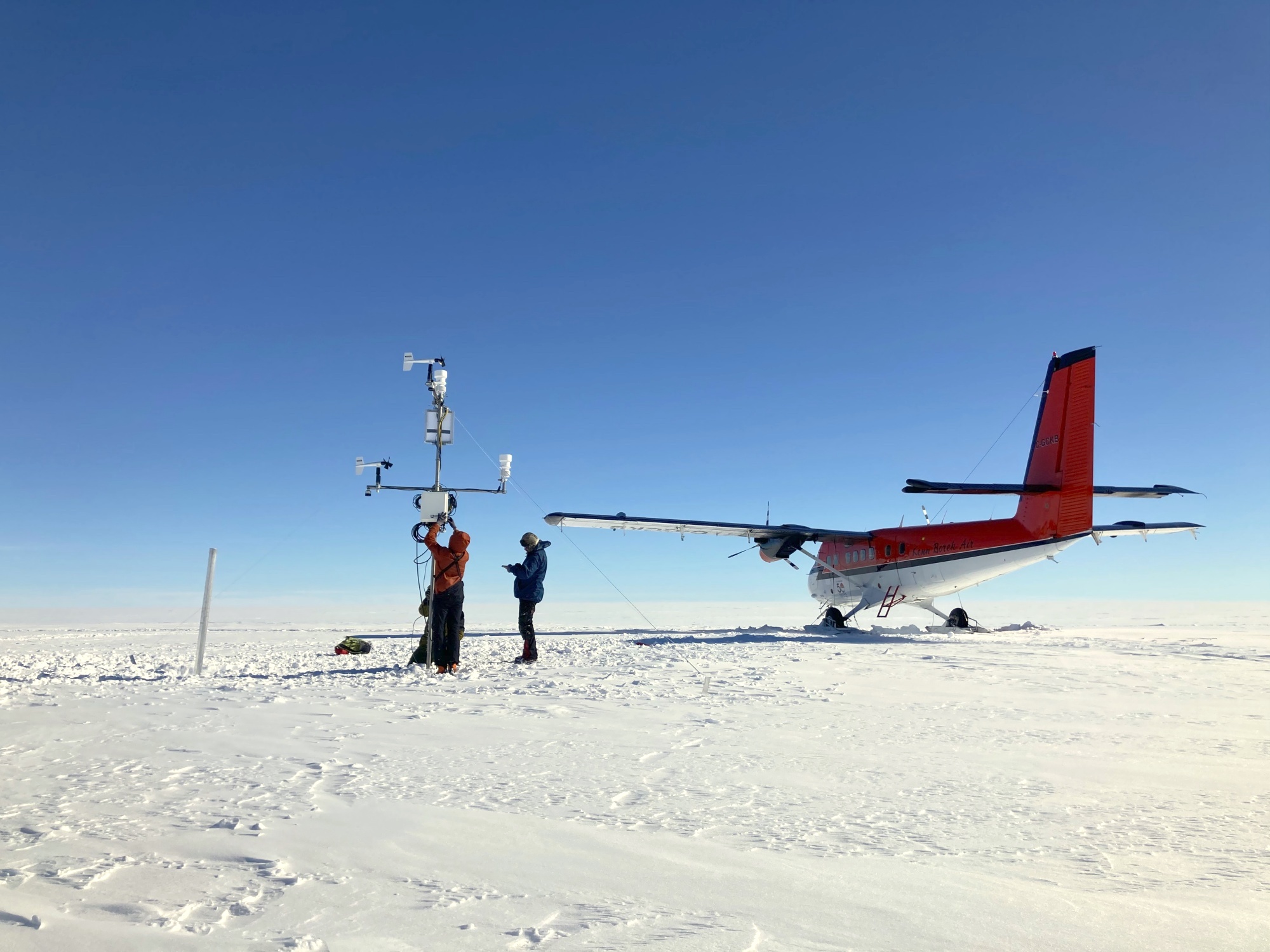
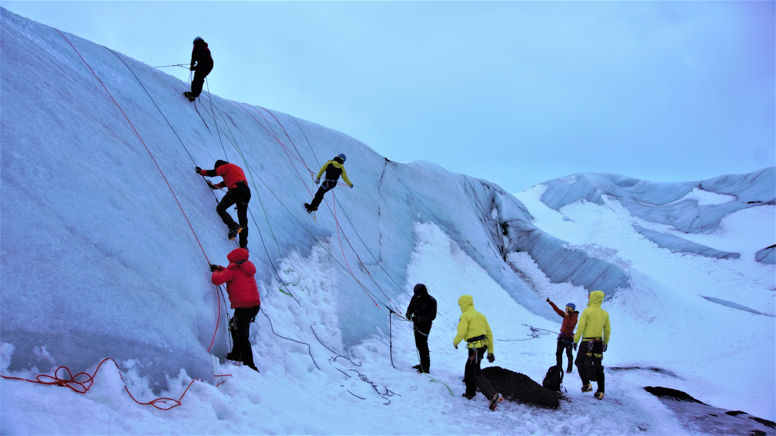
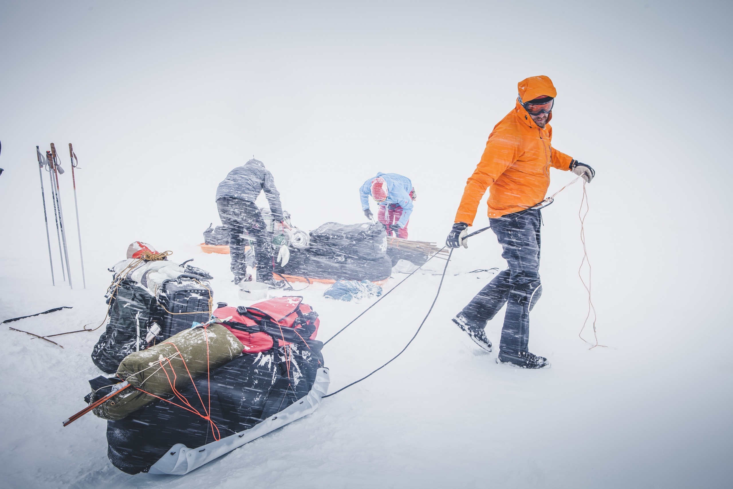
The first team of researchers from GEUS has left for Greenland in the field season of 2022. As of every year, this is the culmination on months of preparing with field logistics and mandatory safety courses.
The field season of GEUS research in Greenland has officially started as of the middle of April. Here, the first team of GEUS (the Geological Survey of Denmark and Greenland) researchers took off travelling to Zackenberg in East Greenland. In the coming months as the Arctic weather gets milder, several teams from the Department of Glaciology and Climate at GEUS will journey all over the Greenland Ice Sheet to retrieve data from and repair/update the automatic weather stations put up by PROMICE and GC-Net. Plus setting up new ones at select locations.
However, to make all of this is possible most of the researchers going on these trips has spent the past months planning and arranging the logistics of getting to the most remote corners of Greenland, bringing lots of equipment and gear.
Besides that, but just as important, the staff going in the field in Greenland has followed – or are going to shortly – several safety courses preparing them for working in these extremely remote areas with harsh environment. A part of the preparations taking place every year as well as booking helicopters, planes and a myriade of other arrangements.
A group of GEUS researchers on the glacier safety course in March 2022 (Photo: Johanne Uhrenholt Kusnitzoff, GEUS)
“For instance, we’ve had almost all our staff on a three-day glacier safety course in Iceland in March and the rest has just been on a repetition course in Denmark,” says Signe Bech Andersen, Head of Department of Glaciology and Climate at the Geological Survey of Denmark and Greenland (GEUS).
The Department of Glaciology and Climate are one of the research departments in GEUS arranging the most field trips to Greenland every year. Since the field work requires going to remote areas with harsh conditions, the researchers and technicians going must be trained in safety skills for glacial environments. Which is what they learn in said glacier safety courses. This includes locating crevasses and being able to rescue each other from them if need be. Which fortunately is extremely rare, Signe Bech Andersen explains.
Nevertheless, having the safety skills needed for critical situations is key, she adds. Because at the same time as training for rescue, the staff is trained in recognizing, accessing, and lowering the risks in any given situation so that the probability of needing a rescue is minimized.
During the glacier safety course, the team practiced choosing the safest path through the rugged terrain of the glacier Sólheimajökull. (Photo: Paul Smeets, Utrecht University)
A range of courses
Therefore, it is mandatory for all GEUS researchers going on field trips to Greenland to follow a range of safety courses besides the glacier course. Most of which must be renewed every third year as a minimum. Thus, prior to the field season most researchers going in the field in Greenland will have skills in:
Arctic first aid
Glacier safety (training on a glacier or repetition in Denmark)
Basic firefighting (for teams setting up camp)
Polar bear safety, including rifle and revolver training (for teams camping in bear territory)
Field work at sea require one or more of these courses:
Basic maritime safety
Basic firefighting
’Gummibådskursus’
Helicopter Underwater Escape Training
https://promice.org/wp-content/uploads/2022/04/1Foto-Paul-Smeets-20220309_103901-scaled.jpg8482560promice_geus_dkhttps://promice.org/wp-content/uploads/2021/09/logo_promice_colour-4.svgpromice_geus_dk2022-04-22 12:46:072023-05-23 13:34:12After months of preparations and safety training: The Arctic field season 2022 has started
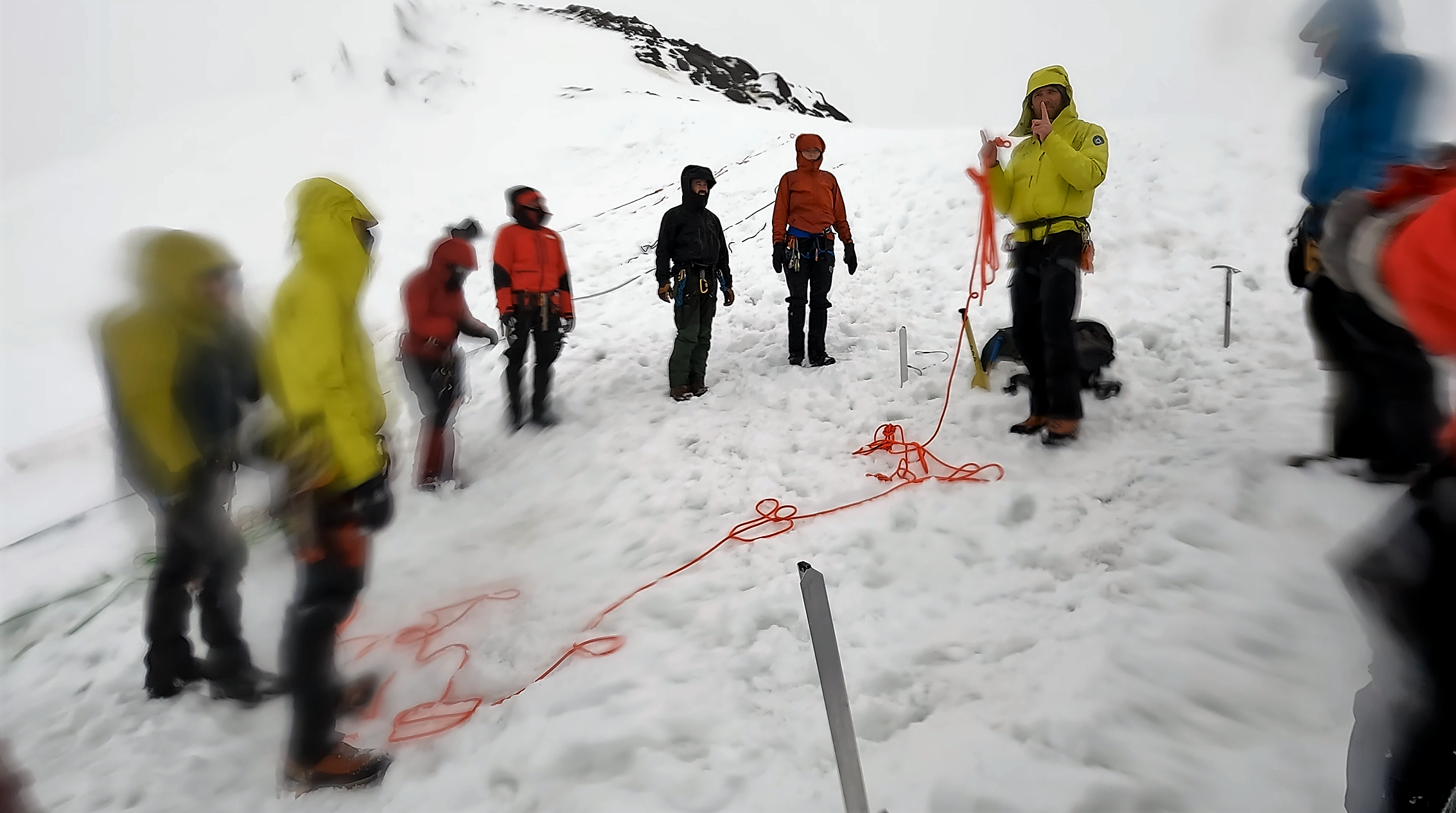
Glaciologists from GEUS practice glacier safety on a regular basis in order to maintain nessecary safety skilld needed for field work on the Greenland Ice Sheet. In March 2022 they went to Iceland to practice safety and crevasse rescue and here you can tag along.
“How the hell do you prepare for that?!” exclaims a shocked course participant on the snow-covered Icelandic slope as her backward tumble down the hill with snow, arms and legs in all directions, is finally brought to a halt.
The fall was deliberately induced about 30 seconds earlier by her rope buddy in a simulation of being a two-person exploration team connected by a rope, one of whom falls into a glacier crevasse and pulls the colleague at the other end of the rope with them.
That is precisely the task of the day: trying to prepare for that situation; having felt the surprisingly surprising fall situation on one’s own body under controlled and safe circumstances. That way you do not get just as surprised if it should happen while working on the Greenland Ice Sheet, where help can be hundreds of kilometres away.
On the training glacier, practicing rescue in very ‘authentic’ weather conditions (Photo: Johanne Uhrenholt Kusnitzoff, GEUS)
On the ridge are nine glaciologists, technicians and assistants from the National Geological Survey of Denmark and Greenland (GEUS) plus three partners from the Dutch Utrecht University. All are busy in various stages of the glacier safety exercise with the goal of stopping one’s own fall down the slope and then hauling your fallen colleague back up. That is, if you even get that far and don’t both fall over the ‘glacier edge’, which today is played by a snow-covered slope in southern Iceland, because the weather on the intended training glacier was too poor.
“Arghh, hang still!” someone else shouts somewhere on the slope, where another two-person team had a more successful self-arrest in the snow, but now rope buddy no. 1 is in big trouble withstanding the pull of his fallen colleague, whose full weight hangs in the harness straps around his hips. And at the same time the fallen colleague is wiggling around down his end of the rope to simulate being in panic.
A minute margin of error
“It’s going to hurt,” our Icelandic glacier guide Jón Andrésson informed us ten minutes before, as he and his colleague Mike Reid played out the scenario for us. And he wasn’t lying. The straps cut into the hip despite the five to six layers of winter clothing. Even though we knew exactly what was going to happen, the body is in shock after suddenly being pulled off balance on the slope and having nothing but snow to grab hold of.
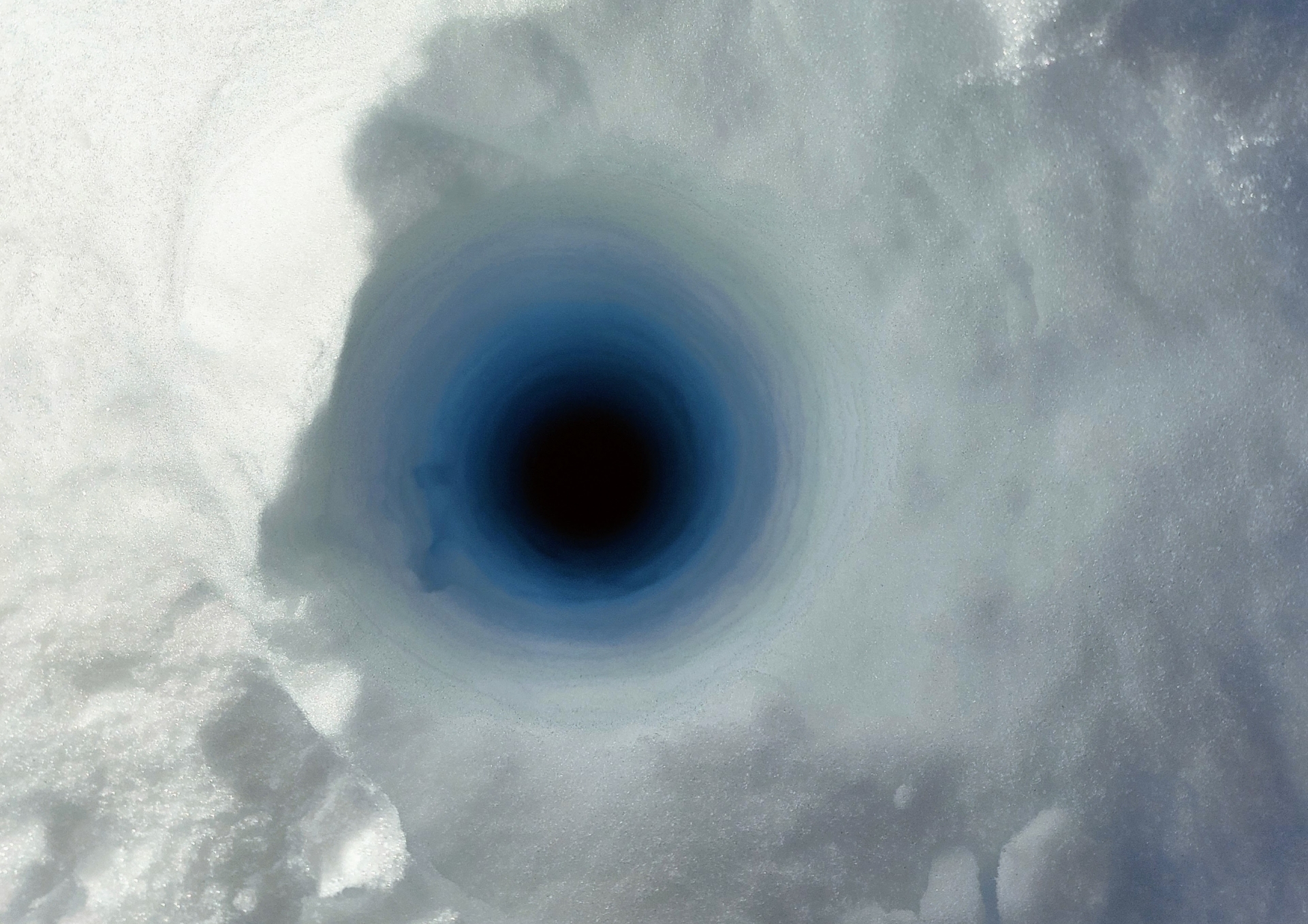
Why does the ice have crevasses?
Ice in a glacier is moving. When the ice moves over rough terrain, or the flow velocity of the ice changes, it strains the ice forcing it to crack. These cracks are called crevasses. Glacier ice will typically flow faster the closer you get to the front of the glacier, which is why this part of an ice cap has the most crevasses.
When you somehow manage to hack your boots into the snow with enough force to stop yourself, it takes all your strength to hold yourself somewhat upright fighting against the pull from below. All your movements have a maximum margin of error of a few millimetres in the most fragile of equilibriums, where the point of balance constantly shifts due to movements and jerks on the rope induced by your distressed colleague at the other end.
And you can’t just lie there. Now your task is, as quickly as possible, pull out your ice axe and dig a trench approximately half a metre deep in the snow in front of you and use the axe to build a so-called snow anchor to which you transfer your colleagues’ weight. If you are not so unlucky to have dropped the axe in your uncontrolled backward tumble down the hill moments before, that is.
With 70-80 kilos constantly pulling on you, you have to find the right rope in your belt, unclick it, tie it around the axe with the correct knot, force the axe down into the bottom of the snow trench, turn around, and tie the anchor rope to the main rope.
The team is practicing to build snow anchors prior to the actual rescue test (Photo: Johanne Uhrenholt Kusnitzoff, GEUS)
Building a snow anchor while holding the weight of a colleague simulating to have fallen into a crevasse while tied up in rope teams. (Photo: Johanne Uhrenholt Kusnitzoff, GEUS)
Now you can – carefully – move back a little and gradually let the anchor rope take over the weight, while constantly keeping an eye on any signs of ‘anchor failure’. That is, the snow axe starting to be torn through the front of the snow trench because the snow is not strong enough after all. If that happens, and you don’t have time to save your system before it fails, you must be ready for a new fall down the hill and to do it all over again. If the glaciers edge doesn’t get there first.
The Icelandic training glacier
All of this is, of course, an exercise.
No one was in danger, and everything took place under the supervision of two experienced glacier guides. As mentioned, on that particular day the glacier crevasse was not a crevasse, but a snow-covered hill. Which was uncomfortable enough as it was.
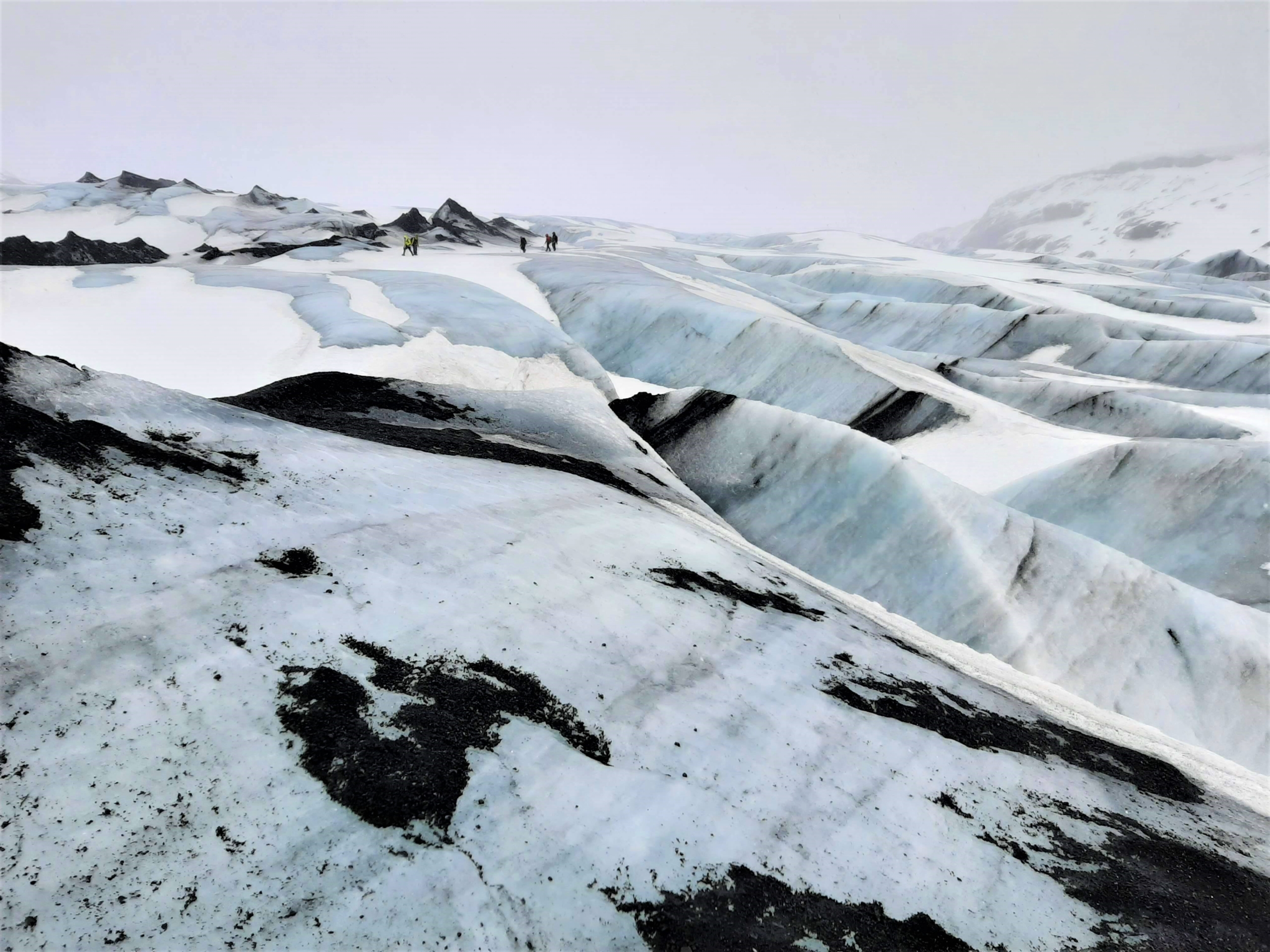
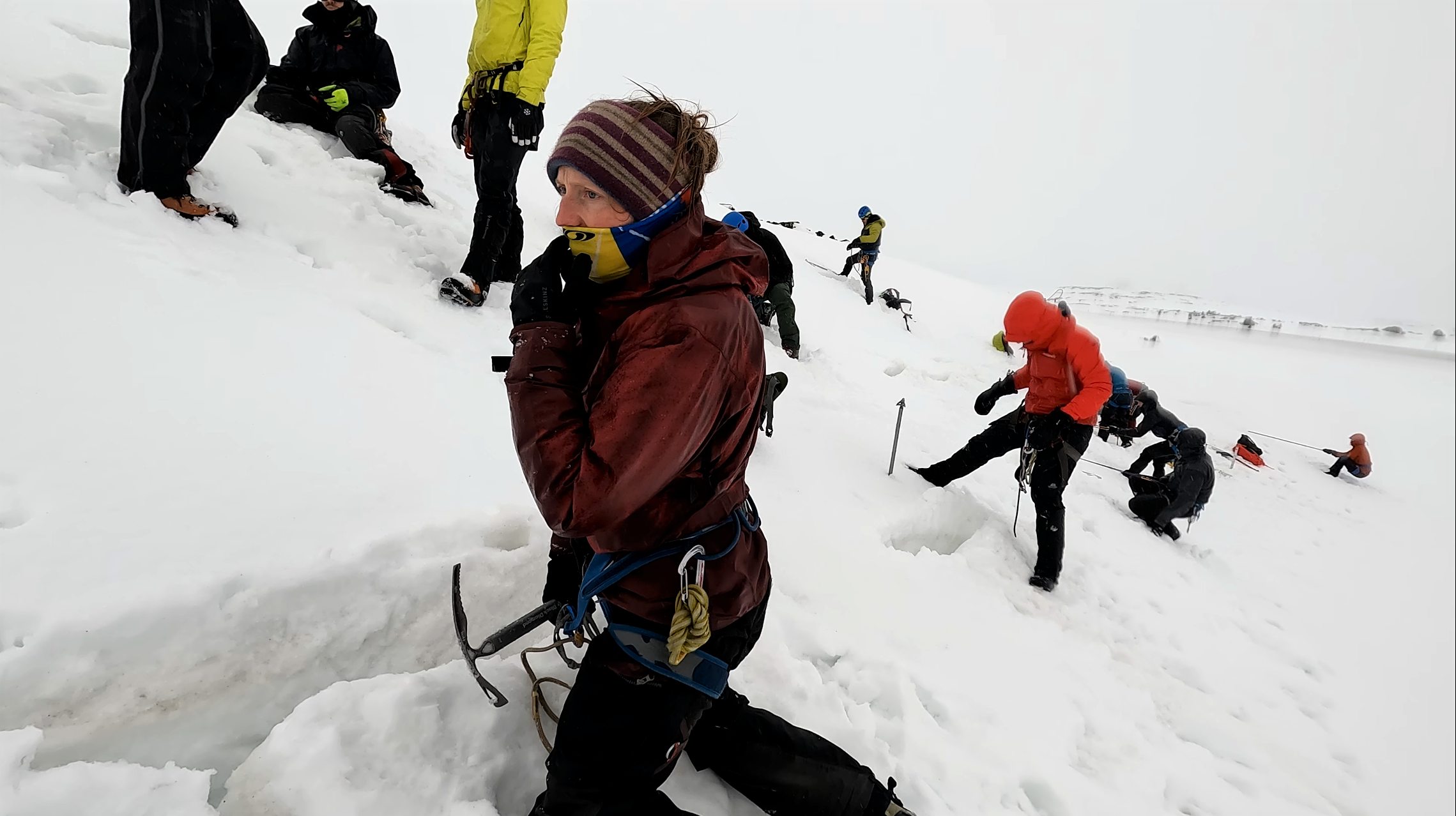
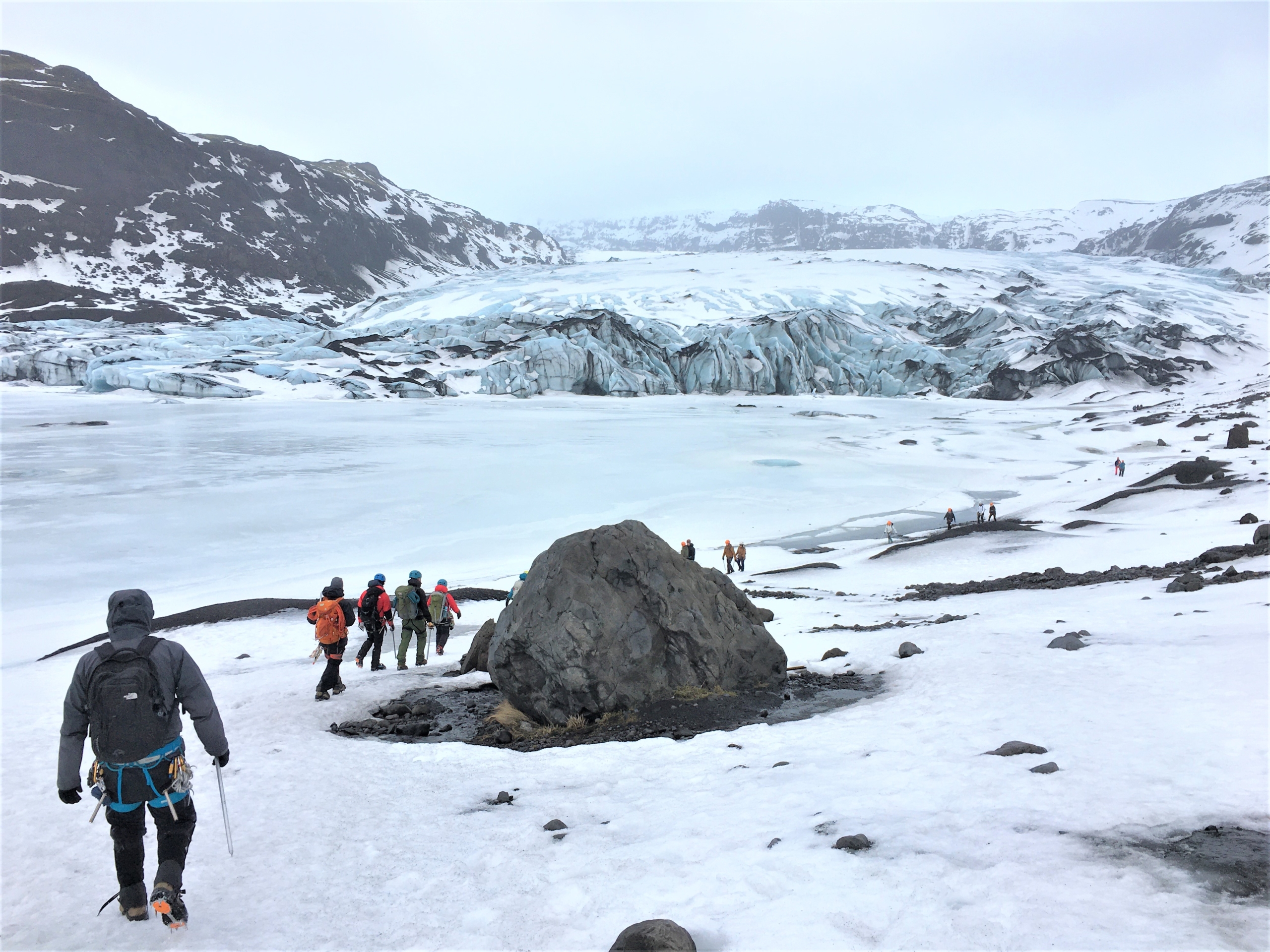
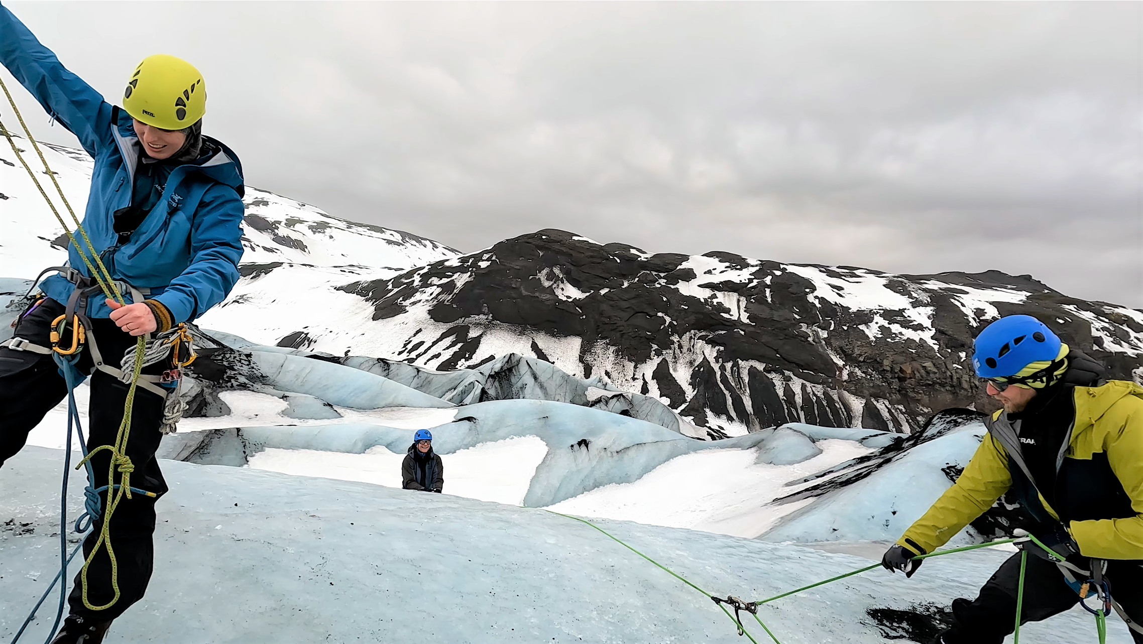
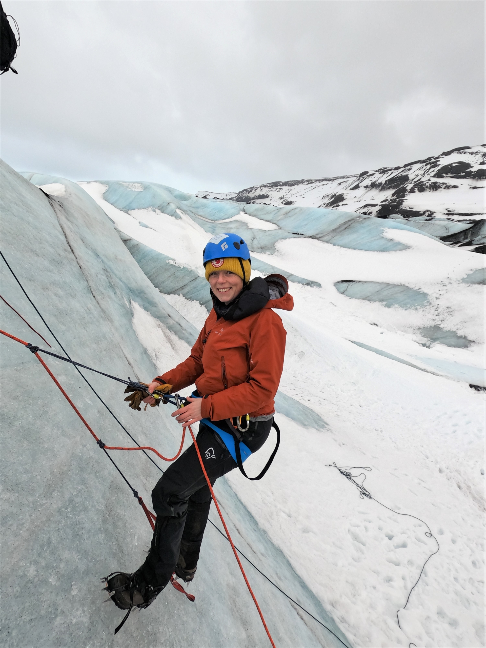
However, the glacier crevasses are a very real risk that must be addressed when the GEUS glaciologists from the Department of Glaciology and Climate, as well as accompanying technicians and assistants, go to the Greenland Ice Sheet each year when they work to uncover, understand and monitor the melting of the ice.
Sometimes the crevasses are not that deep, other times they are several hundred metres deep, full of cascading meltwater and sharp edges. Sometimes they are visible and sometimes they are hidden under freshly fallen snow. The Greenland Ice Sheet is a glacier, albeit a giant one, and therefore it requires knowledge of glacier safety to move around on it. This includes being able to identify where the crevasses are, choosing the safest route, moving around safely on the ice, and being able to rescue oneself and others from a crevasse if – against all expectations – an accident should indeed happen. Fortunately, that is extremely rare.
Safety courses for working on the ice sheet
Employees from GEUS going on field work on the Greenland Ice Sheet always undergo safety training before departure. Some courses are mandatory, but there is always a close connection between the nature and geography of the fieldwork and the courses required. When working on the ice, an updated glacier safety course is requirered, and if the fieldwork requires bringing firearms for self-defense against polar bears, rifle or revolver training is mandatory as well. The courses need to be refreshed at regular intervals, most within three years and some every year.
Still, it doesn’t suffice just reading about it. Therefore, GEUS requires that anyone going to areas of the Greenland Ice Sheet with risk of crevasses must undergo a series of safety courses. The glacier safety course, which takes place over three days on the Icelandic glacier Sólheimajokull, is one of those courses. It is both easier and cheaper to get to Iceland than to Greenland, and a crevasse is a crevasse wherever it is. Sólheimajokull is a couple of hours drive from Reykjavik and is also very easy to access. From a large, gravelly parking lot, you look straight over at the glacier’s serrated, grey-blue mass twisting between two mountain ridges.
In the shelter of the glacier
As we arrive at the glacier before noon on the first day, the enthusiasm has been a bit challenged by rain, sleet and wind pounding ominously against the car windows on the way. However, Jón Andrésson from the guide company Asgard Beyond, who is responsible for the course, is not downhearted.
“It looks a little brighter on the horizon where we are going. And I think that the glacier itself and the mountains behind it will shield us from the wind,” he said in the car. And sure enough: as we jump out of the cars, the wind has subsided, and the rain has almost stopped.
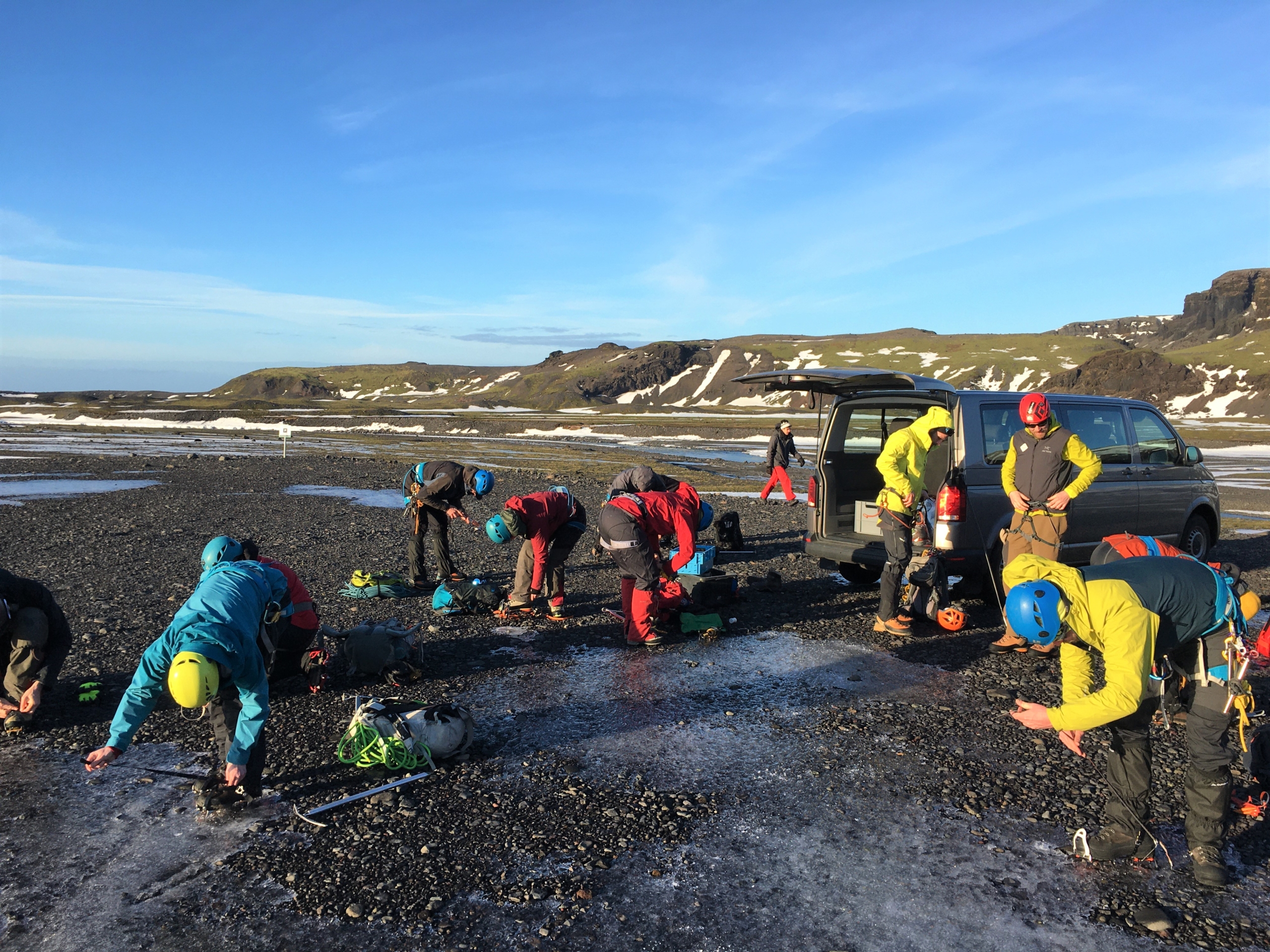
The trunk of the minibus is opened and large buckets full of climbing equipment, crampons and ice axes are hauled out onto the icy ground. A sense of calm concentration descends as everyone pulls on the last layers of wind and waterproof clothing and begins to ‘gear up’. Climbing harnesses are tightened, different types of carabiners, lanyards and pulleys are clipped in the belt together with ropes in different thicknesses and lengths as well as a set of long screws. Helmet on, ice axe in hand.
Gearing up in the parking lot (Photo: Johanne Uhrenholt Kusnitzoff, GEUS)
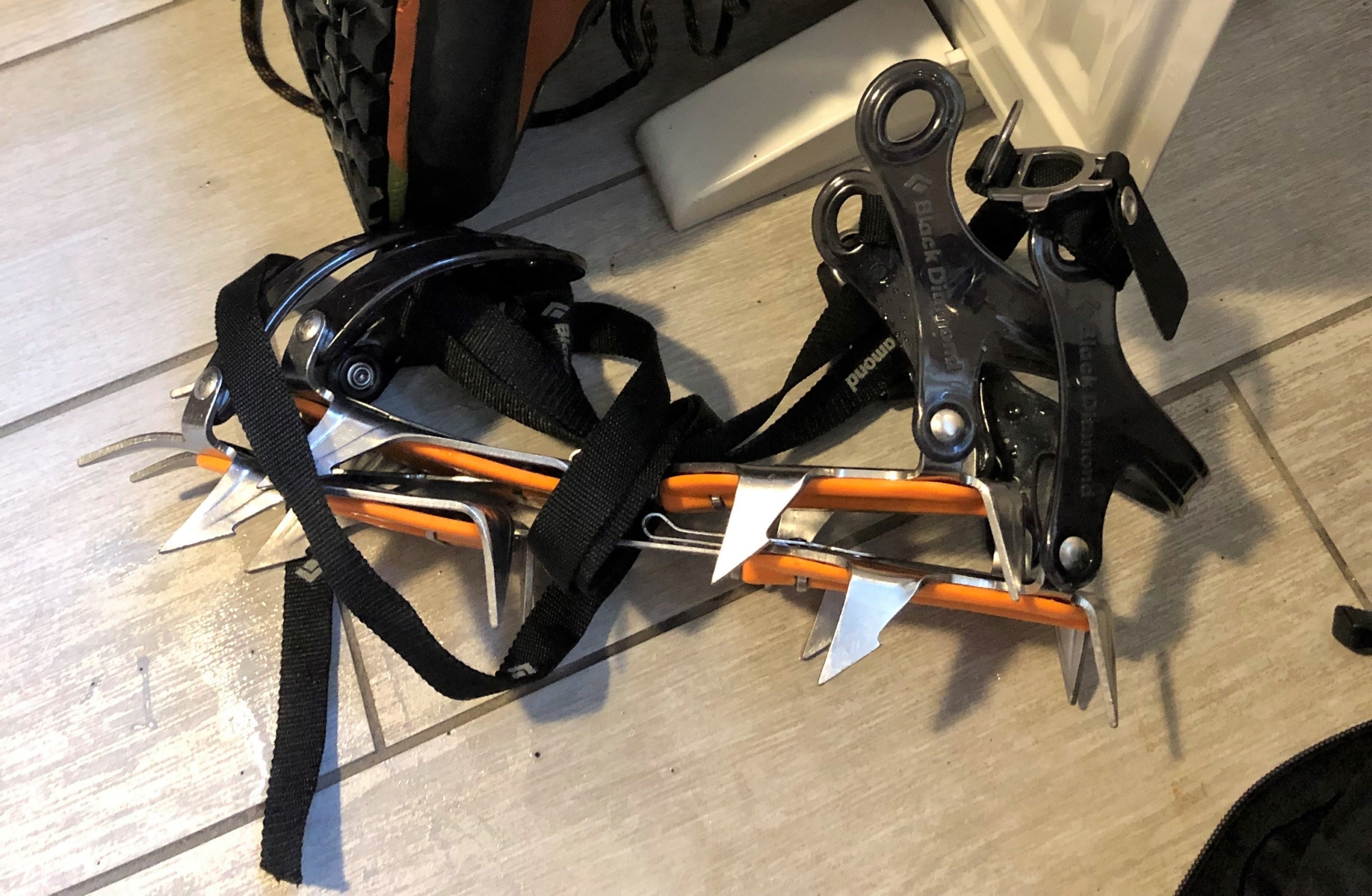
Many have brought their own equipment so they can test the things they will be using on the ice sheet this summer. However, most of us need to borrow crampons, which are soles full of sharp metal spikes that you fasten on your boots, so you don’t slip on the bare ice surfaces.
The pile of crampons looks a bit like props from a death metal music video. Several of the participants are a little unsure about how to put them on, so guide number two, Mike Reid, helps. First, they are adjusted in size, and then they are tied around and around the boot with long black nylon ties like some kind of aggressive ballet shoe.
“OK, is everyone protected against the cold?” Jón asks after ten minutes. “Is everyone geared up?” Off we go.
Slightly more than half of the participants have been attending the course at Sólheimajokull before, or they have been on similar courses on Svalbard, in Switzerland or in Canada. One of the new faces on the glacier is GEUS researcher Signe Hillerup Larsen, who had her glacier course postponed a few years in a row due to the corona epidemic. However, she has been on the Greenland Ice Sheet before and has taken courses in the different climbing and rescue techniques in the forest area Hareskoven north-west of Copenhagen. That is the part of safety training called ‘dry training’ (tørtræning) by the glaciologists: the same exercises as the glacier course, just without the glacier. They do it approximately once a year to keep their rescue skills from the ‘real’ course fresh in mind. Heading towards a wall of ice is therefore not unfamiliar to her.
“I am looking forward to doing the exercises on actual ice, and I have not worn crampons before so that’s good to practice. We do not usually use them in the places where I go; hiking boots are usually enough,” she says.
The parts of the ice she usually works on is usually covered with snow or it is bumpy and rough on the surface due to melting, she explains.
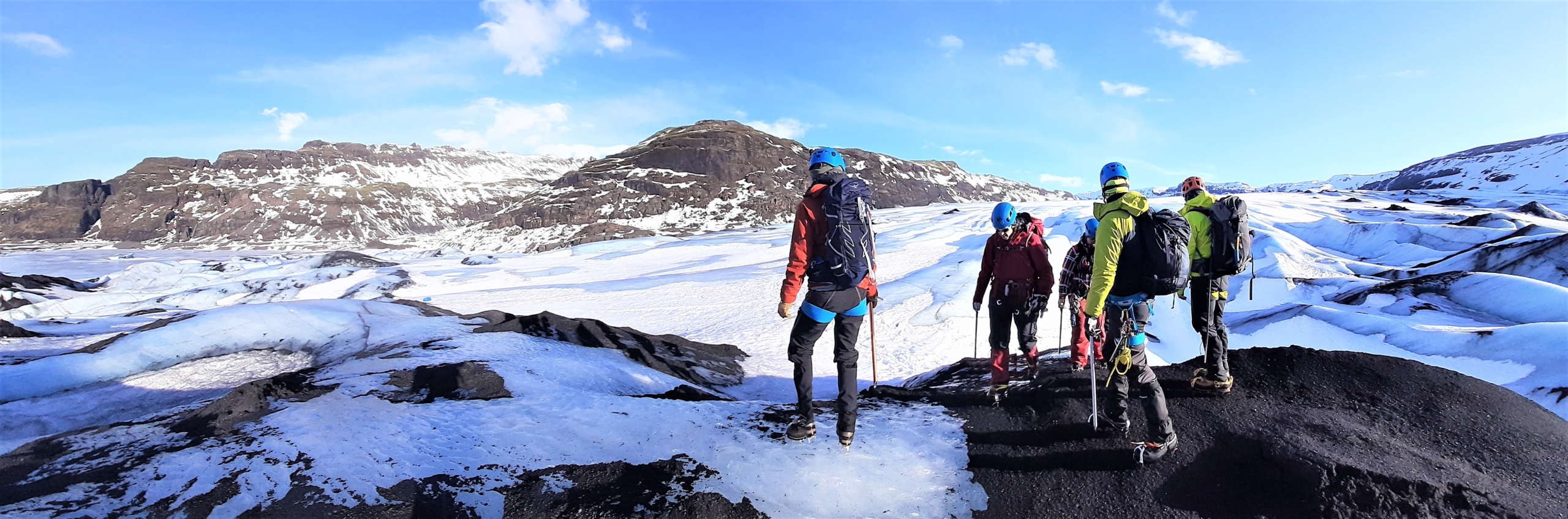
Walking towards the glacier on day one (Photo: Johanne Uhrenholt Kusnitzoff, GEUS)
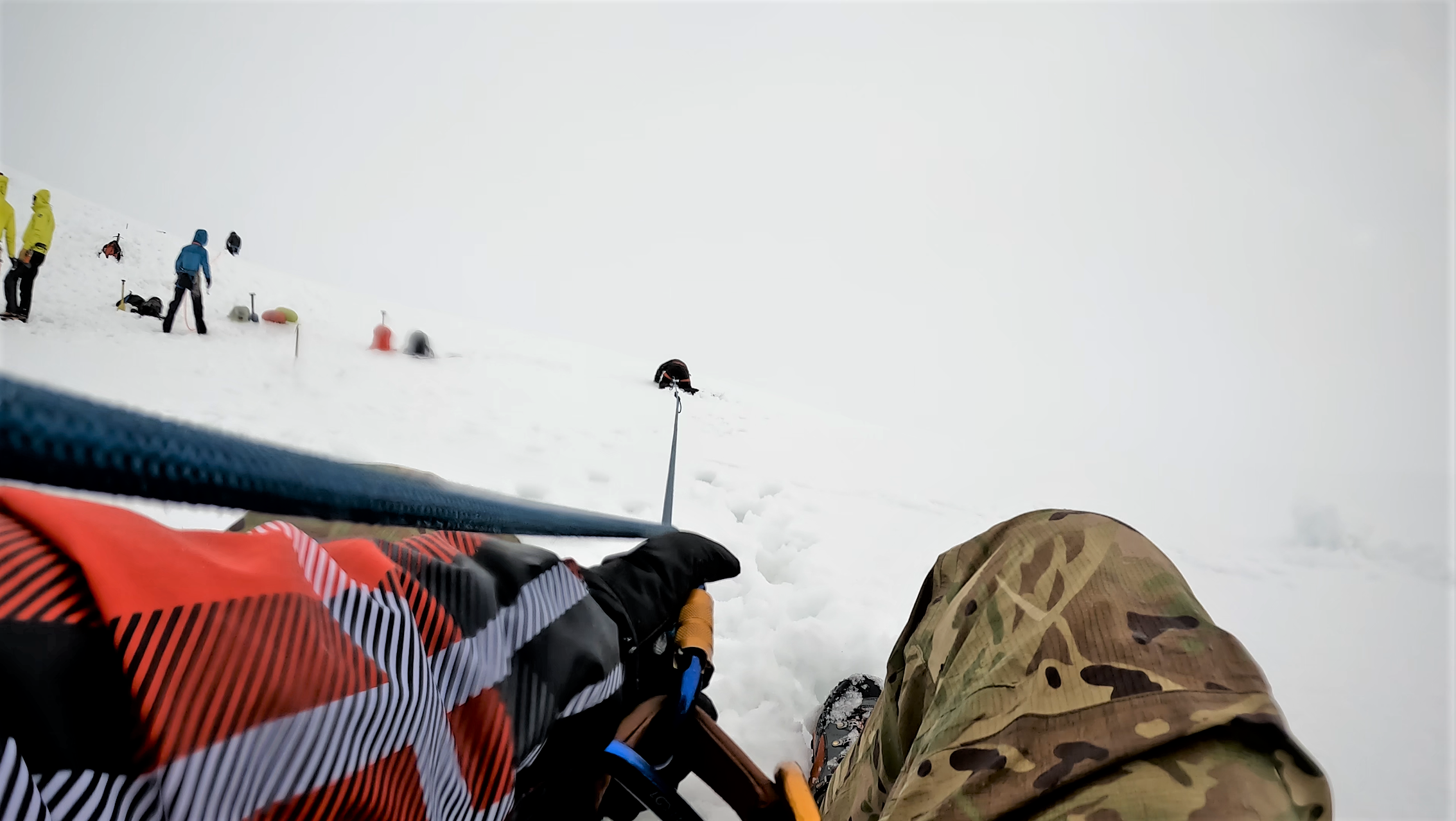
It is about a ten-minute walk to the glacier along the ice covered river of melt water running form the glacier front out to sea. The high frequency ‘shree, shree’ friction sound of the ski pants is mixed with rhythmic, metallic clinking from all the carabiners and ice screws dangling from the belts, and the crispy ‘crunch, crunch’ of 14 sets of crampon spikes cutting into wet snow and layers of ice. At the glacier itself, the caravan of colourfully insulated figures turns left between the blueish grey ice walls as tall as buildings. We walk between enormous frozen waves in an ice ocean, like the Israelites passing through the Red Sea.
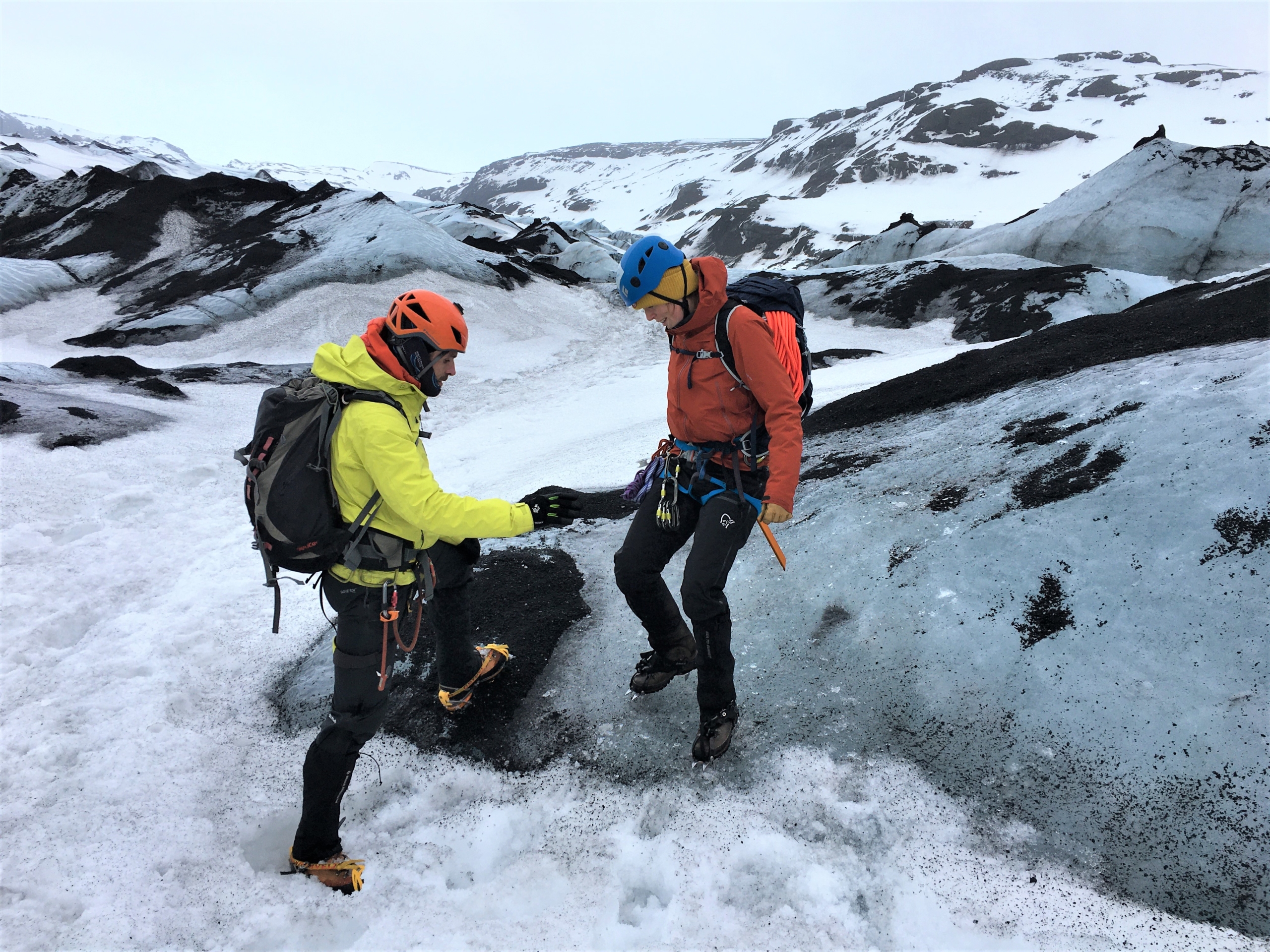
“Let’s stop here for a moment and practice traversing,” Mike Reid says as we pass a slightly smaller wave of ice. Traversing, he explains, just means walking on a steep ice surface wearing crampons. Mike leads the way and shows us how to first point your feet 45 degrees out to each side and kick the spikes well into the ice when you walk upwards. When walking sideways, the foot facing the slope should be perpendicular to the one on the steep side, which is pointing straight forward. Still kicking in the spikes with every step. Walking downwards, you really have to kick in the spikes, lean all the way back and use the axe to support your weight on the wall behind you.
Signe Hillerup Larsen traversing down a small slope while guide Mike Reid assists (Photo: Johanne Uhrenholt Kusnitzoff, GEUS)
“You really have to exaggerate, you should look foolish when you are going down,” Mike says. Everyone has a go. You feel pretty cool wearing shoes that overcome the law of gravity, letting you walk up a bare ice slope. Signe Hillerup Larsen asks if we can have another go. We walk up, sideways and down again for a few minutes until everyone is confident that the spikes really do hold their weight on even the steepest parts of the ice surface.
Then it is time to do the same on an almost vertical surface. Here, the front spikes on either one or both boots are kicked into the ice with every step, so that our weight rests entirely on them. This is called ‘front pointing’. Mike is satisfied with the progress, and we traverse further on into the bluish-white maze.
Time for knots
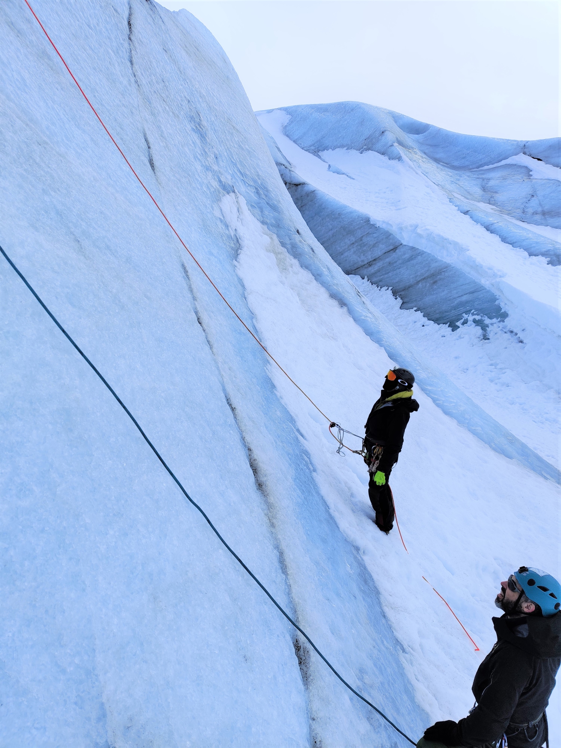
Between two steep ice walls we stop. This is where the rescue exercises are to take place. There is a short break where we eat our lunches bought hastily in a supermarket on the way. The five-six metres tall ice walls shield us from the wind which has been picking up, and they provide an embracing feeling. The walls, however, are not our friends. The rest of the day they will act as a hostile crevasse as we have reached the next point on the agenda. The ability to rescue yourself or others or even things that have fallen over the edge and into the “crevasse”.
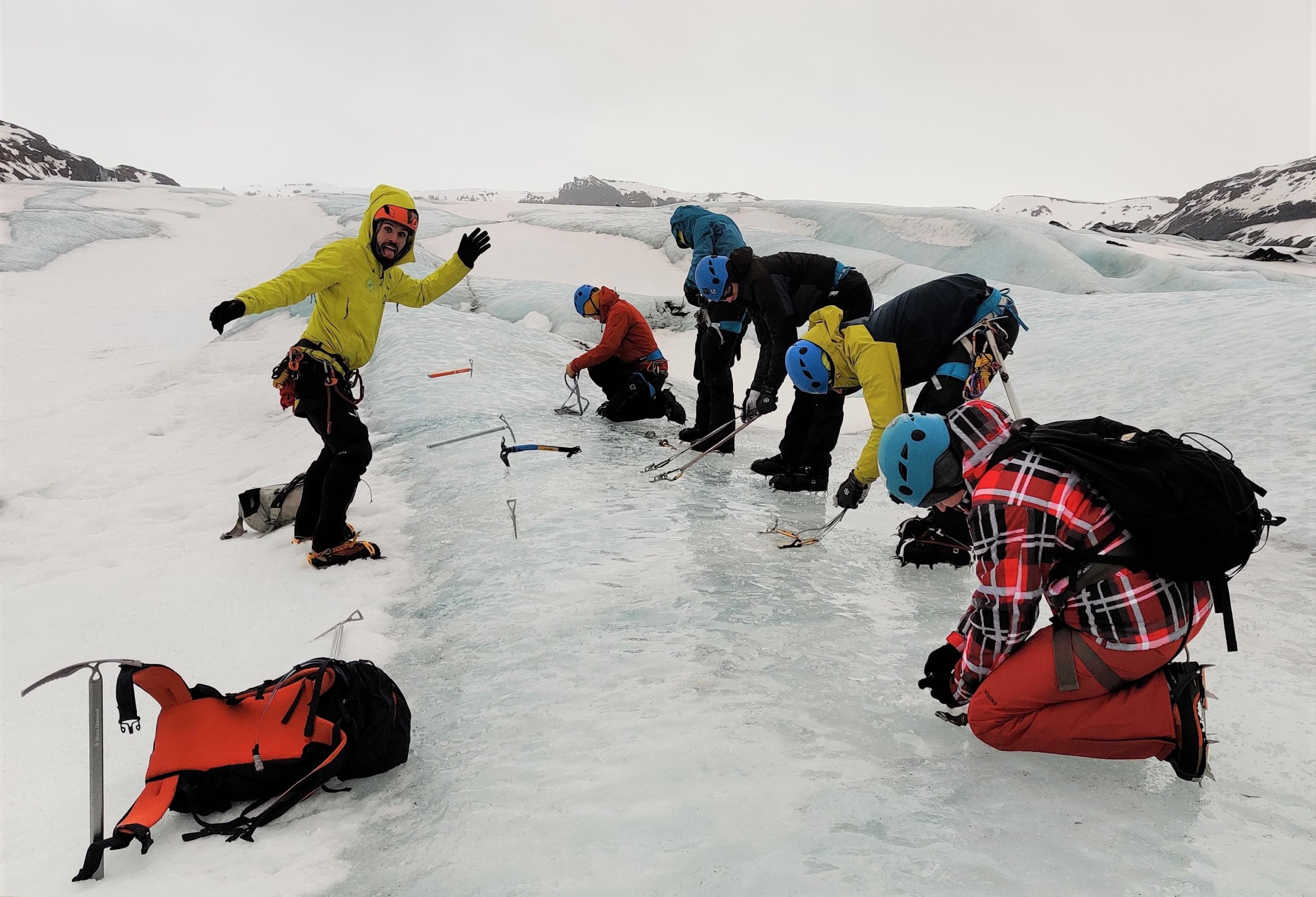
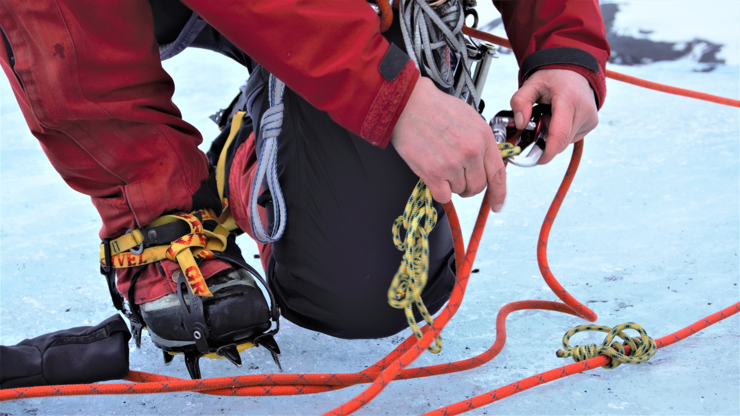
Here, the two long ice screws we’ve all been carrying in our belts come into play. They must be screwed into the ice approximately 30 cm apart and then connected with a strap hooked to a carabiner pointing towards the edge of the ice.
“How you like them apples?!” says Mike Reid gesturing at the demonstration ice anchor which, he adds, holds well over 1000 kilos. Our turn.
Part of the team making ice anchors under guidance of Mike Reid (Photo: Anne Munck Solgaard, GEUS)
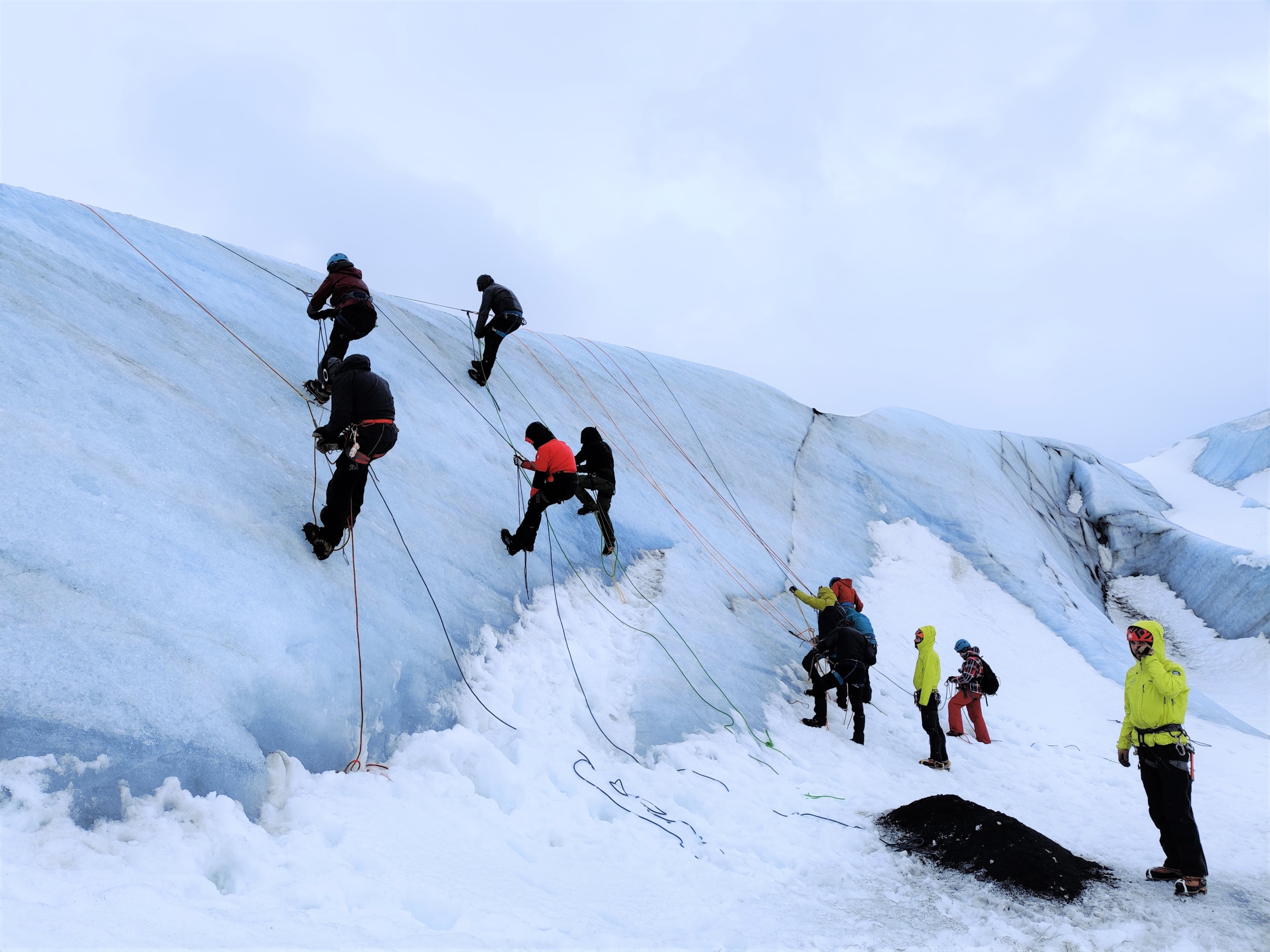
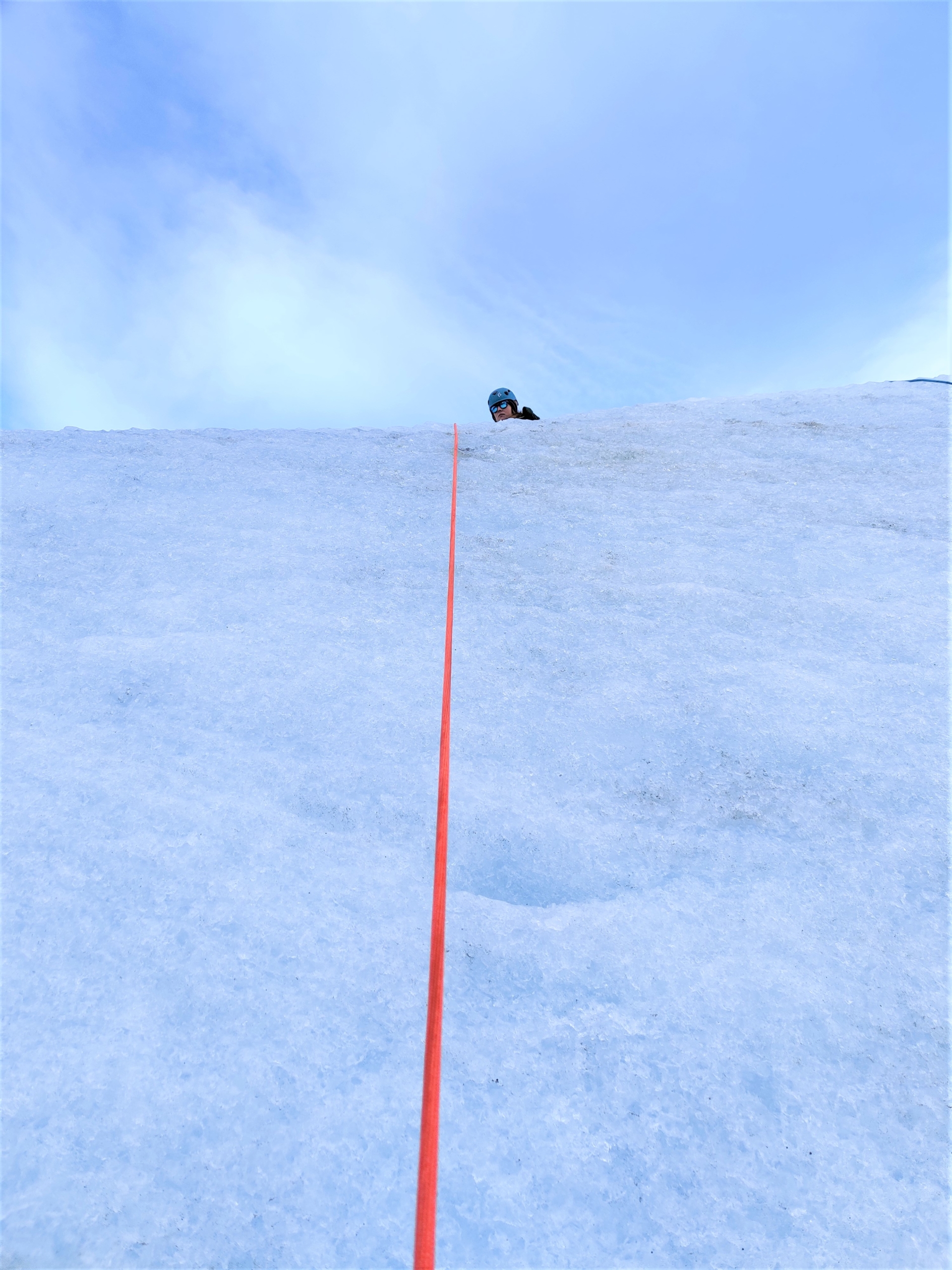
It’s surprisingly effortless working the screws into the ice. Soon after, ice anchors have been constructed all along the ice edge. Now the knot lessons begin. Within minutes, Mike Reid has tied at least four to five different kinds with different ropes and straps from the equipment belt. ‘Clove Hitch’, ‘Prusik’, ‘Figure eight’, ‘Double Fisherman’s Knot’, etc. They are all necessary if you are going to rappel down a rope hanging from the ice anchor. This part almost everyone has become acquainted with on previous safety courses, so it doesn’t’ t take long for the ropes to be put into their rightful states. Before you know it, the first glaciologist is walking backwards out over the edge, disappearing downwards.
The rest of the day – and the first half of the next – is spent practicing rappelling down, then up and then making pulley systems with the ropes to pull others up. This is important because if your colleague has fallen into a crevasse and has broken an arm and can’t ascend themselves, you have to get them up. Go down into the crevasse, hook them to the rope, rappel up, construct a pulley system, and then hoist them. It could also be a climate station that has blown into a crevasse – that has happened before in Greenland.
It’s quite incredible how much weight can be pulled up using a few knots and anti-friction pulleys on a rope. One of the GEUS researchers, Anja Rutishauser, for example lifts up a colleague who weighs about twice her own weight. It is hard and takes a few minutes, but it can be done when using the different pulleys to distribute the weight onto several points on the rope. With three distribution points on the rope, you only pull one third of the actual weight. With five, it’s a fifth, etc. Thus, glaciologists and technicians are hoisted up and down the ice wall for hours. As themselves, as imaginary weather stations, as someone unconscious and a variety of other scenarios.
Professor Paul Smeets from Utrecht University being pulled out of the “crevasse” by his Dutch colleague Maurice van Tiggelen while Anja Rutishauser from GEUS unties her pulley system after pulling her colleague up (Photo: Johanne Uhrenholt Kusnitzoff, GEUS)
Practicing ascending the rope in order to rescue yourself from a crevasse or being able to rappell down to a fallen colleague and rescue him/her (Photo: Anne Munck Solgaard, GEUS)
15 metres reaction time
The morning of day two is bathed in sunshine, and everything is beautiful and icy blue. However, it is more windy and colder than the day before. When there is a particularly strong gust of wind, we only stay upright because we’re wearing crampons, sticking us to the ice. We master the hoisting techniques, so now the difficulty level increases.
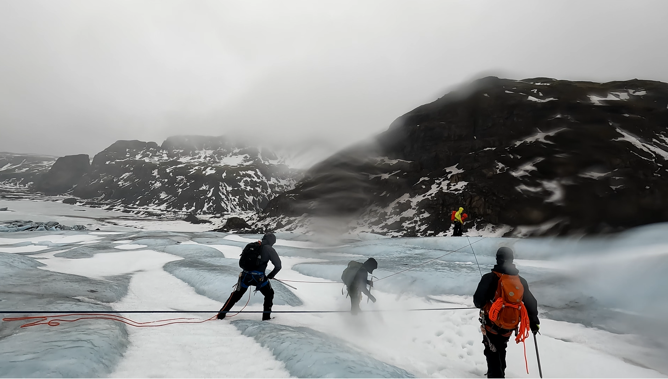
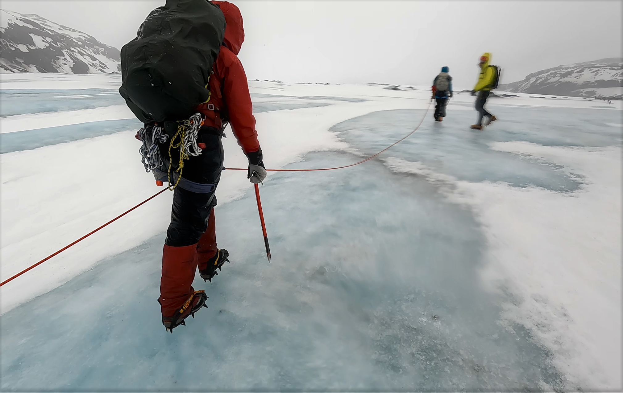
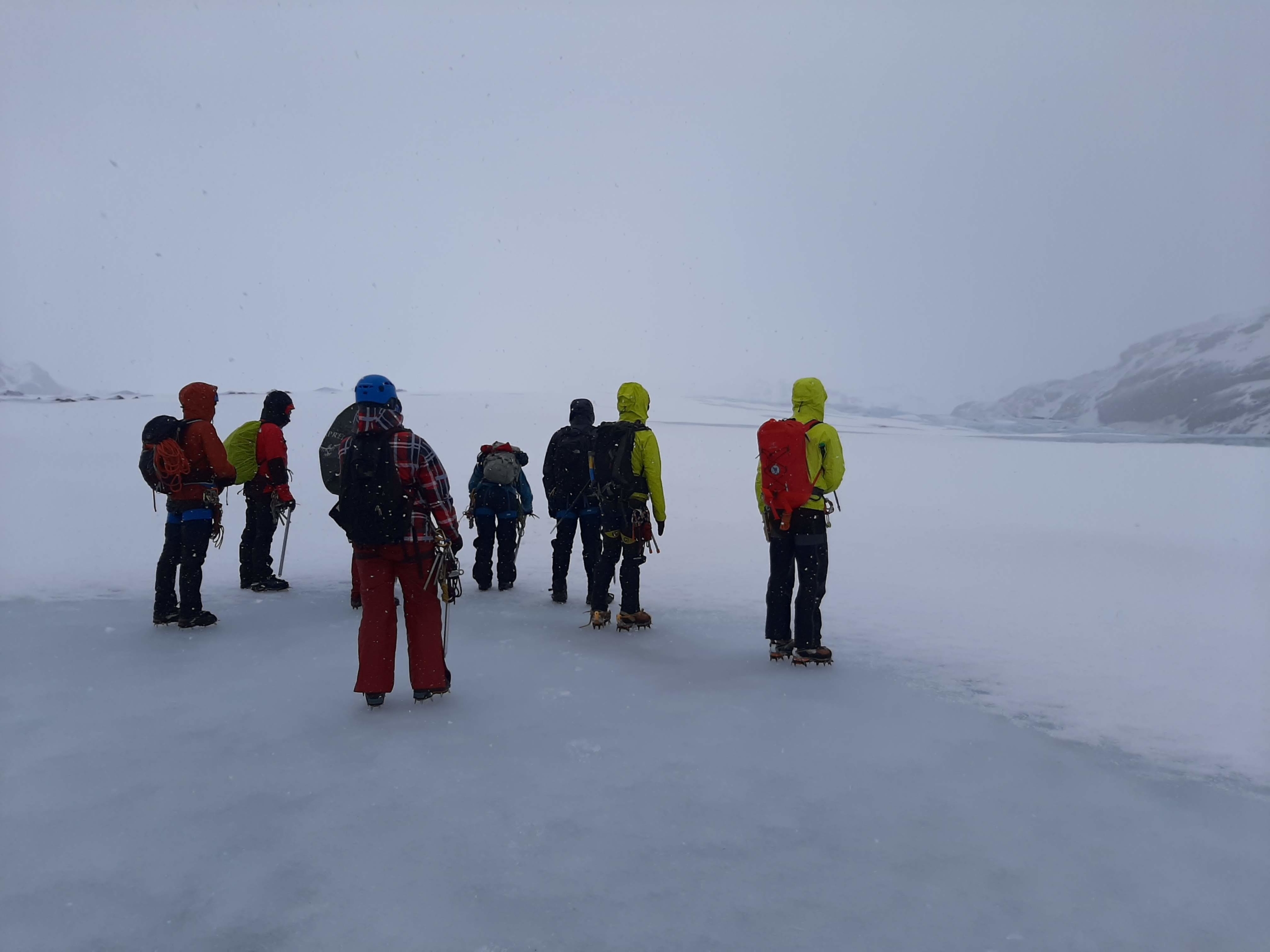
“Now we practice walking in ‘rope teams’ and what happens when someone from our team falls into a crevasse,” says Mike Reid. If you walk in a rope team in a crevasse-filled glacier terrain, where the crevasses may be covered with snow, you should have a minimum of three people on a team, he says. The distance between each of you should be at least 15 metres of rope, preferably more. Which sounds like and looks like a lot, but of course there is a good reason for this.
“If you walk closer together, maybe with five metres of rope between you, you only have five metres, from your colleague falls into a crevasse, until you are pulled in. It gives you a very short time to react, and you probably don’t have time to react, and then you all die.” Well…
Always travel in teams of three or more people. Then there are always two people to hold the weight from the one that falls and the risk of being pulled down is smaller. If you are only two people, it is very hard to hold the other person and the probability of being pulled down is high (which became clear the following day …).
Not feeling the cold
Thus, the seriousness intensifies, and the weather follows. The sun has disappeared, and the wind has picked up even more. Along with the strong wind comes a good mixture of hail, sleet and rain that whips into the face like needles.
“This is more like it, huh?” exclaims Mike Reid. Which would normally be an annoying remark, but several people on the team cheer and laugh as we in the rope teams of three walk further up the glacier, ever more exposed to the elements.
Walking up the glacier to train rescue in rope teams (Photo: Johanne Uhrenholt Kusnitzoff, GEUS)
“This is great!” shouts Anja Rutishauser into the howling wind. The many layers of wool and water/windproofs instil a warm feeling of strength as we stand there on the back of a glacier surrounded by every conceivable form of frozen precipitation but not feeling cold.
In turn, we must now let ourselves fall over an edge, while the two non-fallen rope buddies hold the weight and make ice anchors and pulley systems, respectively. The guides Mike and Jón each take their own sets of rope teams around the entire width of the glacier in search of different kinds of edges and slopes for us to stumble over.
Some have to fall over an icy slope, others down a snowdrift; different scenarios and environments for both fall victim and rescuers. When it’s your turn to be a victim, it’s really nice to just hang out there a bit and make yourself heavy sheltered by your snowdrift while the others work with screws and knots.
When all fall options have been explored and tested and our resistance to cold is declining, we’re done for the day. The hike down the glacier and to the cars takes place in a shared silence.
Waiting for a team mate who fell into deep snow and had to be pulled out. When standing still, the least uncomfortable orientation was away from the blazing wind and hail (Photo: Paul Smeets, Utrecht University)
Walking down the glacier towards the warmth of the cars on the second day in bad weather, even though it’s hard to see. (Photo: Paul Smeets, Utrecht University)
A head full of knots
The first and second day of the course proceed with successful, controlled rescue exercises without any big drama, but that changes on the last day of the course. Here, a minimum of six out of twelve participants along the way are declared “dead” by the guides, some up to several times. Either because our rope buddy on the risky two-person rope team did not succeed in stopping the fall before both go over the edge of “the crevasse”, or because the snow anchor failed.
We are no longer at Sólheimajokull, but on a snow-covered slope along a deserted road somewhere half an hour’s drive outside Reykjavik. At the end of day two, it was clear that the whole area around the glacier would be shrouded in a storm that not even the Icelanders would want to be out in. Fortunately, Iceland is full of steep snowy places, so we need not worry about missing out on more falling scenarios. We just moved the events a bit further to the northwest, where the rain and wind were a little less violent.
However, it’s still bad enough for the whole team to be quite knackered in the middle of the afternoon. We have just practiced a version of a rescue where you are supposed to make bypass large knots on the rescue rope illustrating other rope teammates blocking the hauling of the victim. The gloves are soaked, and icy cold, and extra knots seem to have formed on both rope and brain.
Guide Jón Andressón explaining how to do the knot bypass on the rescue rope. Weather is bad and every one is getting cold (Photo: Johanne Uhrenholt Kusnitzoff, GEUS)
“Jump, face first”
Mike Reid senses the fading spirits on the slope at the end of the exercise and says: “Now you have two options. Do you want to return to the warmth of the cars or do you want to practice ‘self-arrest’ on the hill over there?” We look at him, then at each other.
“Self-arrest,” someone says.
“Great, then come on,” he says, running with impressive speed up the steep, snow-covered cliff.
“Then you just go like this,” he says, as he suddenly lets himself fall freely down the hill. He quickly chops in the ice axe so that snow sprays everywhere, and the fall is ‘arrested’ after maybe ten metres of sliding. This is what we should have done when we were pulled down by our rope buddy …
For a few seconds, several of the researchers stand in the middle of the slope and look hesitantly down towards the bottom. However, everyone has been falling in so many weird ways in the last few days that it doesn’t really seem to matter anymore. One by one, we let our legs slide out and zoom down in a shower of snow and an instant adrenaline rush. It requires some effort to force the ice axe properly into the snow while sliding, so several of the participants slide all the way down the hill some 40-50 metres below.
“Then try and do it face first,” Mike Reid shouts all the way from the top, and does exactly that. Like a bright yellow projectile, he darts down the hill with his arms close to his body, before deploying the ice axe, which then turns him around and stops his fall in the middle of the slope. Not before long, glaciologists are flying down the hill in all sorts of orientations. When people stop themselves, they run up and go again.
For twenty intense minutes, everyone forgets that they were quite cold and wet, snow and ice do not matter. At the end, the sun even breaks through the clouds. Eventually the cold returns and the group walk through the wet snow to the cars. Jón Andrésson gathers the threads before we split up:
“There have been many things going on over the last three days, many techniques, and scenarios. Overall, you have to remember that we have simply trained being able to rescue ourselves and others from a crevasse. So, consider the risks where you are. If there is an accident, keep cool and figure out what makes sense here and now. That’s about it.”
Glacier safety course
Day 1
Walking on ice with crampons
Making an ice anchor
Rappelling up and down a crevasse
Weather: Rain/sleet and wind, periodically nice. Ca. 4oC, windchill ca. – 6.
Dag 2
Terrain risk assessing, picking the safest route
Glacier rescue, building a pulley system for hoisting a person/item from a crevasse, different scenarios
Traveling in three-person rope teams on a glacier, terrain risk assessing
Glacier rescue in three-person rope teams, different scenarios and rotation
Weather: Sun in the morning, from mid-day strong wind, hail and sleet after lunch. Ca. 2oC, windchill ca. –9
Day 3
Making a snow anchor
Glacier rescue in rope teams of two, including stopping a fall on a snow-covered hill
Glacier rescue in rope teams of several people, bypassing knots on rescue rope
Stopping a fall with an ice axe/’self-arrest’.
Weather: Heavy wind and rain, change of location necessary. Wind and rain, which die down in the afternoon. Ca. 5oC, windchill ca. – 6.
Day two, during terrain analysis (Photo: Paul Smeets, Utrecht Univertity)
Day two, part of the team choose to rappel down an ice wall while making their way towards the training “crevasse” (Photo: Johanne Uhnreholt Kusnitzoff, GEUS)
Researcher Signe Hillerup Larsen from GEUS on the ice wall on day one (Photo: Anja Rutishauser, GEUS)
Day two, waiting to be hauled up (Photo: Anne Munck Solgaard, GEUS)
Day two, the one on top doing the hauling. (Photo: Anne Munck Solgaard, GEUS)
https://promice.org/wp-content/uploads/2022/04/1Foto-Paul-Smeets-20220309_102913-scaled.jpg19202560promice_geus_dkhttps://promice.org/wp-content/uploads/2021/09/logo_promice_colour-4.svgpromice_geus_dk2022-04-22 11:35:292023-05-23 13:34:23Field preparations: Training for worst-case glacier scenarios in Iceland
This year, the annual documentary festival CPH DOX opened with the film Into the Ice, a documentary following three glaciologists in their work on the Greenland ice sheet. One of the scientists is PROMICE professor Jason Box from the Department of Glaciology and Climate at the Geological Survey of Denmark and Greenland (GEUS) in Copenhagen.
During his work investigating the mass balance of the ice sheet, GEUS Professor Jason Box was joined by a film crew on several field trips in from 2019, 2020 and 2021. In the documentary just released as opening act at CPH DOX festival, we follow Professor Box in South Greenland down the southern ice sheet to collect snow samples.
The film director Lars Henrik Ostenfeld states in a voice over that the ice contains a secret and Prof. Box states “you have to listen to the ice” stressing the need to go to the ice instead of relying solely on satellite observations. And going to the ice is exactly what Professor Box and the PROMICE team does every year, collecting observations, data and samples from snow, ice, climate, rain and ice algae and more. All of which in combination with satellite data and models makes the researchers able to check the satellites and improve the climate and sea level rise models. The work adds hard numbers and gets a deeper understanding of exactly how the multitude of ice dynamics affect each other and alter the overall melt now and in the future.
Amongst other things, Box is working to understand what happens when a warmer climate with more moisture in the atmosphere, makes for heavier snowfall on the ice sheet providing a layer of insulation whilst increasing rain events pull in the other direction, enhancing melt. An ongoing project at PROMICE (watch the video ‘How much snow falls on Greenland’).
Professor Jason Box with colleagues and film crew on the ice sheet in southern Greenland. (Photo: Lars H. Ostenfeld)
Lowering the risks
The ice sheet field work is beautiful and fascinating, but includes risks, as becomes clear through the film. Crevasses, storms and deep moulins (melt water wells) pose a risk when moving around on the ice. But, as PROMICE project manager and GEUS senior researcher Robert Fausto explains, the team uses ‘best practice’ to manage risk, bringing down the probability of harm to “an acceptable level”.
One tragic scene marks a point in time from where the safety on all field trips to the ice sheet was tightened even more: The accident in August 2020 where one of Professor Box’ colleagues, glaciologist and director of the Swiss Federal Institute for Forest, Snow and Landscape Research, Konrad Steffen, falls into a water filled crevasse and doesn’t make it out.
The PROMICE team has a procedure where the staff going on field work participates in safety courses at regular intervals securing that all necessary skills are up to date. This includes Arctic first aid, bear safety and glacier travel safety courses. Here, they practice rescue scenarios and build skills required for field trips such as the ones shown in the documentary.
Professor Jason Box at a rain gauge (Photo: Lars H. Ostenfeld)
https://promice.org/wp-content/uploads/2022/03/Jason-Box-with-ice-core_credit-Lars-H.-Ostenfeld-scaled.jpg17072560promice_geus_dkhttps://promice.org/wp-content/uploads/2021/09/logo_promice_colour-4.svgpromice_geus_dk2022-03-23 16:06:052023-05-23 13:34:41‘Into the Ice’-documentary follows PROMICE to the ice sheet