Study presents new view on geothermal heat flow in Greenland and Antarctica
Researchers from The Geological Survey of Denmark and Greenland (GEUS), University of Colorado, NASA, John Hopkins University, University of Maryland, University of California and University of Alaska have developed a new method to account for variations in geothermal heat flow caused by sub-glacial bed topography under the Greenland and Antarctic ice sheets.
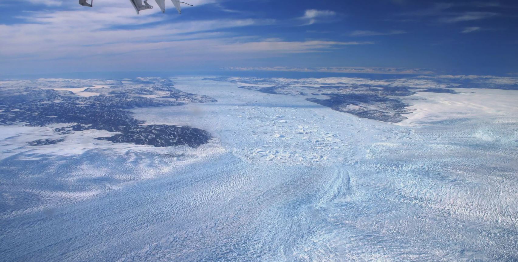
View over the deeply incised glacier Jakobshavn Isbræ. Photo: William Colgan
Presently, there is a lot of uncertainty about the magnitude and pattern of geothermal heat flow beneath the Greenland and Antarctic ice sheets, and models do not account for variable bed topography.
In a newly published study led by GEUS, researchers have developed a statistical method for correcting geothermal heat flow models to make them consistent with known subglacial bed topography.
Heat flow is stronger within glacier valleys
It has been known for over a century that geothermal heat flow is greater in valleys and smaller on ridges. In this new study, the researchers have examined the effect of the ice-sheet bed’s topographic relief on geothermal heat flow to generate the first comprehensive snapshot of changes in geothermal heat flow at scales of hundreds of meters. They found that geothermal heat flow in several regions—most notably central East Greenland and the Antarctic Peninsula—is routinely doubled within glacier valleys and correspondingly halved along ridges.
“Basically, if the heat escaping Earth’s interior is looking for the quickest way to radiate into the atmosphere, a deeply incised valley provides the fastest exit. This effect is readily observable from the fact that geotherms – surfaces of constant temperature – are packed more closely together beneath valleys, indicating a stronger temperature gradient there – and hence heat flow – in comparison to ridges,” says William Colgan, Senior Researcher in the Department for Glaciology and Climate at GEUS and lead author of the new study.
Geothermal heat flow can change drastically across hundreds of meters
The researchers behind the study created a simple statistical model to estimate this topographic influence on geothermal heat flow and applied it to digital elevation models of the sub-glacial topography beneath the Greenland and Antarctic ice sheets. The result was a much more detailed geothermal heat flow map than what is usually seen.
“We are showing that instead of being something that changes gradually across tens of kilometers, geothermal heat flow can change drastically across hundreds of meters. This might really change how people think about variations in geothermal heat flow, not only beneath the ice sheets, but also other regions on Earth where there is a lot of topographic relief,” says study co-author Yasmina Martos of NASA and the University of Maryland.
Improved ice-flow predictions
According to Colgan, knowing the temperature distribution within the ice sheets is essential for creating accurate ice flow models.
“If you run a computer simulation of an ice sheet with a severe over- or under-estimation of the geothermal heat flow, you can easily end up generating an ice sheet that is either too warm or too cold. Ice flow is very sensitive to temperature – particularly near the bed – so geothermal heat flow is a critical variable for simulating the form and flow of Earth’s ice sheets,” Colgan explains.
The researchers behind the study hope that these topographic corrections for geothermal heat flow will be adopted into present-day ice-flow models to improve ice-flow predictions.
The method can also be used to estimate the influence of topography on geothermal heat flux in non-ice covered areas. The researchers hope to next create a global model to account for the effect of topography on geothermal heat flow across the entire Earth.
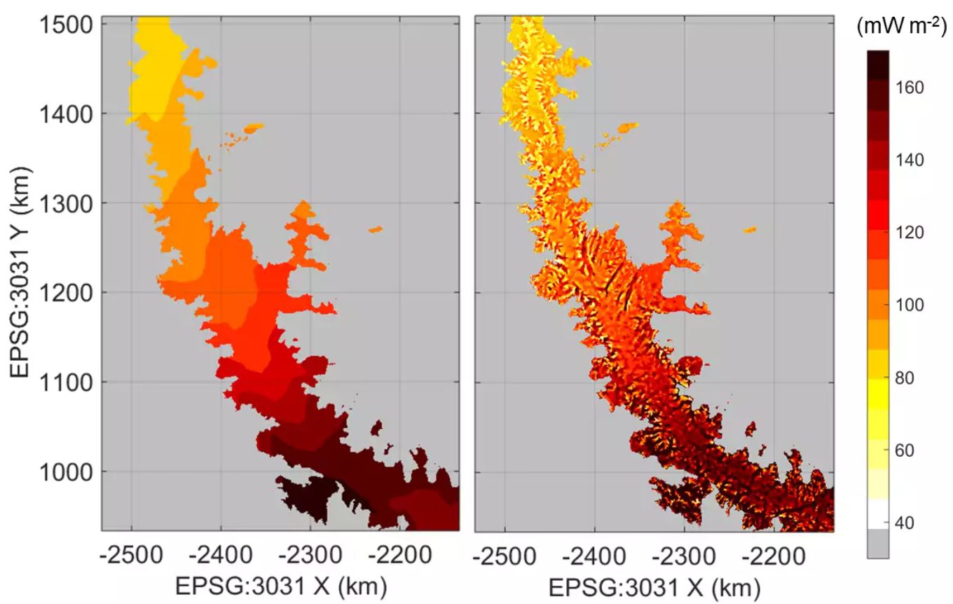
Left: An existing regional geothermal heat flow model. Right: Regional geothermal heat flow corrected for local topographic relief.

